
Last bike trip: Juune 2012
Cycling the French Riviera (Côte d'Azur), Part II:
From Hyères and Giens to Saint Tropez, Cannes, Antibes, Nice, and Menton.
Bike Rating: Some sections Excellent or Very Good, others Moderate to Poor
Train connections allow skipping poor sections.
Total Distance: 330 kilometers (200 miles)
Difficulty: Mostly easy with some moderate and hard sections
Best Season: June or September, avoid July and August
Link to Page 1, Oveview, Recommendations, and Sections 1-3: From Marseille to Cassis, Bandol, Toulon, Hyères and Giens.
Detailed Itinerary (continued) for Cycling the French Riviera (Cote d'Azur):
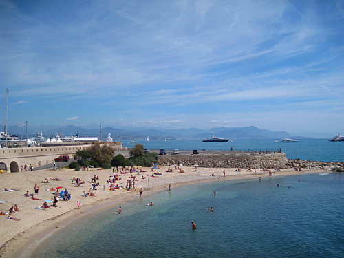
Section 4: Biking from Hyères, via Le Lavandou, Saint Tropez and Sainte Maxime, to Saint Raphaël .
Distance: approximately 80 kilometers. Rating: Good.
Recommendation: Consider riding Section 4 if you want to visit costal resorts, such as Le Lavandou, Saint-Tropez and Sainte-Maxime. Stay one night in Saint-Tropez or Sainte-Maxime and combine the rest of Section 4 with Section 5.
Section 5: Biking from Saint Raphaël to Cannes.
Distance: 36 kilometers. Rating: Very Good.
Recommendation: Ride Section 5 to see the terra-cotta-colored Esterel Mountains. Stay one night in Cannes.
Section 6: Biking from Cannes to Antibes to Nice.
Distance: 31 or 38 kilometers. Rating: Excellent.
Recommendation: Ride section 6. Walk your bicycle around Antibes or lock it temporarily about 2 km out of town. Stay two or more nights in Nice.
Section 7: Biking the Grande Corniche from Nice to Menton
Distance: 33 or 38 kilometers. Rating: Excellent but a stiff climb.
Recommendation: Ride Section 7. If you are up to the climb, the views are unforgetable. Rocquebrune and Menton are well worth a visit. Stay in Menton or return by train the same day to Nice.
Section 4 — Biking from Hyerès via Le Lavandou, Saint Tropez and Sainte Maxime to Saint Raphaël via Saint Tropez.
Distance: approximately 80 kilometers; 11 km more to visit Saint Tropez. Rating: Good.
After Hyerès, the next costal train station is in Frejus-Saint Raphaël. Between the two there are 30 kilometers of bike paths, bike lanes and back roads, while 50 kilometers is on a highway with medium traffic.
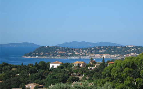
If you are cycling on past Saint-Raphaël to Cannes, I would recommend breaking your journey in the pretty little town of Sainte-Maxime, though Michelin gives it no stars. Saint-Tropez, with two Michelin stars, is another possibility, but: a) it is expensive, and b) it is no longer the cute village of Brigitte Bardot, but rather a tourist-filled town of only moderate charm, facing a harbor containing some of the world's largest yachts. In my opinion, skip Saint-Tropez if you are going to be visiting Monaco - Monte Carlo. Otherwise, visit.
The simple instructions for this entire section are: Follow Highway D559 northeast. Some details:
On leaving the Giens Peninsula, you ride in bike lanes, and then on a minor road next to a salt-marsh visited by hundreds of species of birds.
Along the bicycle path after Hyères.
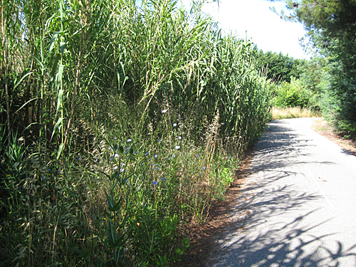
This cycling is excellent, but then one reaches D559 from Hyères, and rides through urbanized areas on a bike path next to the road. Approaching Le Lavandou, you ride on a bike path on the trackbed of the ancient rail line, the train des pignes (train of pine cones). Often in cuts with no view, but at other times on a hillside with views of the Mediterranean, the train des pignes bikeway runs along near the highway for almost 15 kilometers. There are plans to extend it further, but I saw no sign of any work in progress. Then it is highway riding. Along this stretch, hills covered with villas fall to the sea, while resort towns with their beaches and yacht harbors occupy the low-lands.
Cavailaire-sur-Mer.
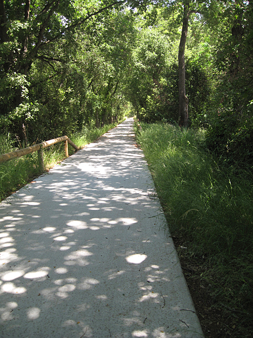
At the east-end of Cavalaire-sur-Mer a bike path recommences, and in 1.6 kilometers turns inland joining a lightly used road. This climbs, meandering, to the pass (at about 100 meters elevation) of Croix Valmer. Ride up the shopping street and at its end watch bike route signs carefully; you must angle to the right and cross the highway. Now you ride downhill on a newly-created, highly pleasant, bike path mainly in the woods. At the bottom, near the Gulf of Saint-Tropez, you ride briefly on the road before rejoining cycle a cycle path. If you wish to visit Saint-Tropez, turn right and follow signs.
Bike Path in woods descending to Gulf of Saint-Tropez.
The main bikepath follows alongside D559 again through Port Grimaud, and turning east along the north side of the gulf, it continues almost all the way to Sainte-Maxime.
Children's Merr-Go-Round Sainte-Maxime.
After Sainte-Maxime, you ride on the highway until Saint-Aygulf. A bike lane leads into town. At the traffic circle angle right, staying on 559 (Av. du Train des Pignes). After the bridge onto the peninsula., and as D559 curves left, angle right onto a bike path between the shore and a pond. When this ends, you are in Frjus-Saint-Raphaël
I found getting through Fréjus and Saint-Raphaëlit to be rapid and almost traffic free: After one block on Ave. Eugene Joly, on which you come into Fréjus, turn right on Bd. de la Mer and ride 600 meters. Turn left on Rue dei Perdigau, and at the T turn left again. This curves around a harbor on your right to a roundabout where you turn right on Av. de Port Frejus. At the Y bear left and then go right. At the T at the sea, turn left onto Bd. de Algers. Follow this along the sea. It curves sharply right entering Saint-Raphaël, and is one-way in the direction you are riding. Follow this around a sharp curve to the left.
If you are continuing towards Cannes, stay on this road (highway) which is again D559. If you are going to the railway station, where the road begins curving to the right again (after 4 blocks) be in the left lane and turn left and at the Y bear left. You are in front of the railway station.
.
Section 5 — Biking from Saint-Raphaël to Cannes
Distance: 36 kilometers. Rating: Very Good.
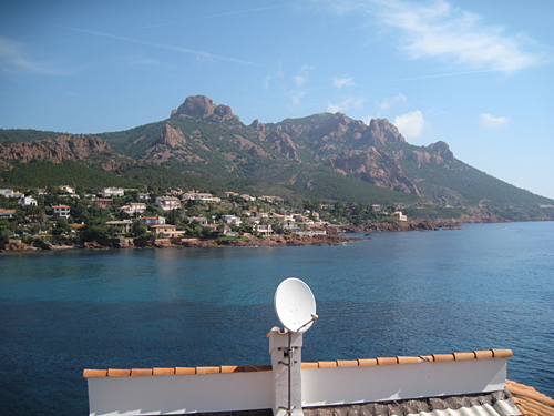
The route between Saint-Raphaël and Cannes — D559 in the Var Department, D6098, in the Department of Alpes Maritimes, is mostly along the seaside corniche (cliff) of the Esterel Mountains, and receives a Michelin rating of three stars. The terra-cotta-red (sometimes ocher-red) rocks of the mountains form a stunning contrast with the deep blue of the Mediterranean.
View towards Antheor village and the Estérel Mountains.
The entirety of this section is on the highway. Commercial traffic is minimal until near Cannes, but tourist traffic picks up after 10:00 AM. Do not expect to be the only bike if you are riding in summer or on a weekend. It is a favorite route for local cyclists. After a flat start, the route becomes rolling, then climbs to 90 meters, and then becomes flat again near Cannes. Beaches line much of the route, some with red sand.
Estérel view near Pointe de the Pointe de l'Observatoire.
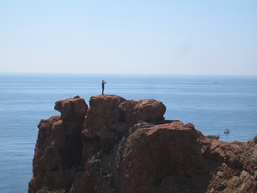
The train follows this same route, but whizzes by too quickly and without stoppiing! Even on a bicycle you can whiz by paying attention to the road, and not seeing what you should. I recommend stopping at each of the Sémaphore du Dramont, the Pointe de l'Observatoire, and the Pointe de l'Esquillon. Each is noted by roadside signs. Lock your bicycle and walk out to the sea.
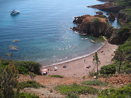
Estérel pocket beach.
The seaside road, D6098 narrows coming into Cannes, with cars parked bumper to bumper. For safety, ride out from car doors, and make vehicles wait to pass you. When you reach Cannes harbor, you may wish to walk your bike and see the yachts.
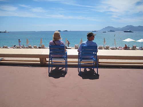
Folks enjoying the Croisette, Cannes. Estérel in distance.
To reach the railway station, from the northeast corner of the harbor walk or ride four blocks eastward on the Croisette (the seaside walk of Cannes), and go left (north) for 200 meters on the Rue des Serbes .
I recommend a one night stay in Cannes. Staying in the center of Cannes, between the rail line and the beach, will be expensive (and impossible during the film festival in the second half of May) but very convenient for walks along the Croisette and on the main shopping street, the Rue d'Antibes. Cannes is the most chic of the Riviera towns, filled with luxury shops carrying fashion and food temptations. Yet the Croisette has a relaxed atmosphere. Some beaches are public, and some private. At the private beaches you must pay an entrance fee, or pay by having an expensive lunch, but you could stash your bicycle out of harm's way.
Section 6 — Biking from Cannes to Antibes to Nice
Distance: 31 or 38 kilometers. Rating: Very Good.
Cannes to Antibes:
Leave Cannes to the east. If you are in the center of the town, I favor taking the Croisette to its southern tip, and then riding northeast along the coast until you cross the tracks and come to the roundabout. You could just as well take the Av. des Hespérides across from the Croisette, or even quicker, Bd. Alexandre III directly to the roundabout. From the roundabout ride northeast along the Mediterranean in the bike lane of the highway. In 2 kilometers, take the exit ramp over the rail line into the town of Golfe Juan, riding along the sea. The road is narrow and in-town; there can be some traffic here, which you will block, but the total distance is only 3 kilometers. Then you enter Juan-les-Pins, and you can ride on the esplanade along the sea. The main road angles left, but you can continue straight for several blocks, finally being forced to angle left away from the sea into a walking-only street for one block. At the Y bear left still walking your bike for one block, as the traffic is against you. Then ride one more block, slightly to the right, to a traffic circle.
The beach at Juan-les-Pins.
Here you have a choice: a) Either continue slightly to the left on the Av. de Sables (some traffic). Follow this for 1 kilometer, up over the crest of a hill and down, curving left, through a traffic circle (now Bd. du Cap) to another large traffic circle by the sea, where the long route comes in. This is shorter, but there is nothing special about it.
b) Or, take a tour of the Cap d'Antibes, which is 6.5 kilometers longer, home of the rich and famous, along the sea, but beautiful and more interesting. Do stop and admire the port, sculpture, and the views. To do that, take the first exit from the roundabout (i.e., to the right - south). Stay along the shore as long as possible. The road eventually makes a loop to the left and heads northeast (Bd. John F. Kennedy). You pass the famed luxury hotel, Hotel du Cap-Eden Roc. When the road is curving left to due north, if it is a Wednesday morning or afternoon not in July or August or a holiday, at the junction consider riding south on Ave. Mrs.. Beaumont for 750 meters to see how one rich American couple lived in the early 20th century. Admission is free. Villa Ellenroc was designed by Charles Garnier, the architect of the Paris Opera, and was decorated with Art Deco furniture. It now belongs to the city of Antibes. Though the estate is not well kept, it gives an idea of the opulence of the time. Return to Bd. Kennedy. When Bd. Kennedy has curved due north, at the Y go right onto Bd. de la Garoupe, and follow this back to the shore, (name changes) to the big traffic circle where the short route comes in.
Continue north, staying as close to the Mediterranean as possible. When the road leads up onto the ramparts, walk your bicycle along the ramparts of Old Antibes. The street is one-way against you. You have excellent views. The Museum Picasso is on our left. You descend from the ramparts near the gate leading north out of the old town.
Pocket beach in Antibes, ramparts, and yachts. Nice and Cap Ferrat in distance.
It would be a shame not to see the center of the old town on foot. However, it is not safe to leave a bicycle, no matter how well locked, in Antibes. I have telephoned several garages there and also discussed this on the phone with the Tourist Office. There is no place to safely park a bike in Old Antibes. So if you are not spending the night in Antibes, and you wish to walk there, you should consider leaving your bicycle locked to a pole on the Cap d'Antibes, a couple of kilometers before the town. Those who steal bicycles during the day are unlikely to go there. There are some possible streets off the Ave. de Sables or back from the beach.
The harbor at Antibes.
Antibes to Nice:
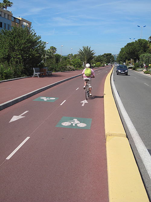
Leaving Antibes, you go west and then north around the very extensive harbor, then pick up the bike lanes of the costal road. In 4.5 km, when the costal road starts to curve left away from the sea to go around a complex of multi-story apartment buildings, bear right onto a minor road by the sea. This road soon turns left to follow around the buildings, and curves right. Turn right when possible, riding through a passage under the buildings towards the sea. The road loops around to the left back towards the buildings, but you make a right turn, and follow along the curve of the harbor. When the harbor ends, turn left and ride one block, where a bike path starts, becoming much wider after the bridge. You will follow this wide, very enjoyable bike lane all the way into Nice. There are a few (well-signed) road crossings, some slow riders, and inline skaters, so take care. The speed limit is posted, and at least one town, Cagnes-sur-Mer, deploys gendarmes to enforce it.
Looking back on the bike path in Cagnes-sur-Mer (shortly before Nice).
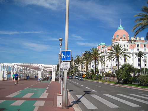
Metropolitan Nice is France's fifth largest, with about one-half million people, and yet Nice also remains an important resort, crowned by its stunningly beautiful walking-cycling-rollerblading route along its Mediterranean pebble beaches — the Promenade des Anglais. Wherever you may be staying, I recommend concluding your ride in Nice by riding all the way to the end of the bike path — past the domed Negresco Hotel, Nice's most prestigious and expensive hotel, past the old town and beneath the hill of the Chateau, and along side the Port, where the bike path ends.
Looking back at the bike path on the Promenade des Anglais, Nice, near the Negresco Hotel.
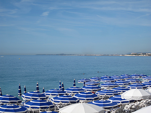
Nice: View with umbrellas of the Bai des Anges to Antibes.
There are many sights in Nice, great shopping, and many excellent museums, including the Musée Matisse and the Musée Marc-Chagall. Purchase a good guide book, and stay at least two nights. The number of bike routes around the city of Nice is growing rapidly. See this link.
Section 7 — Biking the Grande Corniche from Nice to Menton
Distance: 33 or 38 kilometers Rating: Excellent but a stiff climb.
The Grande Corniche road runs along the steep slopes from Nice to Menton. This part of the French Riviera differs from the others: the Alps plunge into the Mediterranean and life is vertical. Many people would dread living here. On the other hand, if you would to love to live on a steep mountainside with a wide-angle view of the sea, the Corniche is your place. Whichever may be the case, you must at least once see the views from the corniches and the towns on or below them. If you don't want to cycle, by all means rent a car or take a bus tour.
There is very little traffic on the Grande Corniche (except light traffic for the first kilometer leaving Nice and for the last few kilometers descending into Menton). If you don't have the time or the desire to overnight in Menton, trains back to Nice from Menton run every half-hour for most of the day. To visit towns near or on the coast, such as Monte Carlo, I recommend taking the train. See the final paragraphs below.
Harbor at Saint-Jean-Cap-Ferrat, with view of the Corniches behind.
Directions:
From the end of the bike path, at the northwest corner of the Nice harbor, turn right, ride one block; turn left, ride one block; turn right, ride two blocks; and turn left. You are heading north on Bvd. Lech Walesa, soon to become Bd. de Riquier. There are several blocks of bike lane. After 1.2 km, turn right on the well marked route for the Grande Corniche (D2564), which begins climbing. For the first 2 km, the average grade is 10%. After a level stretch, the climb continues at 6 - 8 % over another 2 km. Beyond, there are some easier climbs.
Now level at about 500 to 550 meters (1,600 -1,700 feet) above the Mediterranean, you continue along, stopping occasionally to admire the view. After passing through the pleasing village of La Turbie, begin descending towards Roquebrun and Menton. If you have time, I recommend a visit to the perched village of Roquebrun. The dungeon there is the oldest in France; the mediaeval village is charming; the views are stupendous.
Afterwards, continue your descent into Menton. If you continue straight you will come into the commercial center of Menton. Rather, I recommend turning right as soon as possible after crossing under the rail bridge, and at the Promenade de Soleil on the Mediterranean turn left. You can ride on the esplanade along the Mediterranean if you prefer. End your trip where the Promenade turns north, below the old town. You have a clear view towards Italy. Or, you may ride along the Mediterranean as far as the border with Italy, and then back (5 km round trip).
Menton is a beautiful city of unified architecture. It is famous for the mildest climate in Europe, and many foreigners who resided here established gardens, now public, that are full of tropical plants and worth seeing. I recommend walking your bicycle up into the old town and locking it briefly to visit the church and the cemetery. Note the mountain ridge to the east of the town that forms the border with Italy. The Alps come closest to the Mediterranean here: the little notch you see is at 1,100 meters (3,500 feet), and yet it is only 3.3 kilometers from the sea.
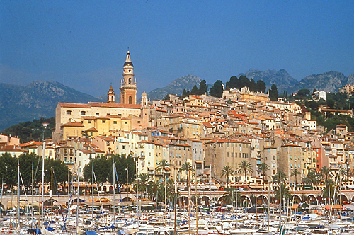
Menton old town from the harbor.
To reach the train station, backtrack along the shore for 0.7 - 0.8 km. Turn right, go 1 block (sign for D 6007), turn left, go one block, and the turn right again, going uphill through the gardens. When you reach the rail line, turn left and ride 100 meters to the station.
I do not recommend riding back to Nice along either of the other Corniche highways. On both, traffic can be heavy. If you chose to do so anyway, ride the Moyenne Corniche. (Eze Village** is worth a visit, but it will be extremely difficult to push your bicycle up the slopes to the village.)
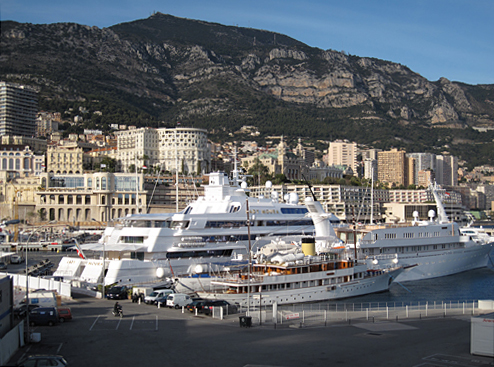
Visit Monte Carlo-Monaco***, by all means, but take the train there. Monte Carlo-Monaco roads are steep, tricky, and full of traffic. Pedestrians block progress. If you do have your bicycle with you, see if you can lock it in one of the parking garages while you visit. It would be better to leave it behind in Nice. The Cousteau Oceanographic Museum of Monaco (Aquarium) is worth a two-hour visit, as is the castle plaza, the port, and the center of Monte Carlo. Consult a guide book or tourist brochure.
Monte Carlo with supersized yachts. Grande Corniche is by cliffs. Visit Monaco by train and on foot.
If you want to visit Cap Ferrat**, home of the richest patriarchs of the world, bike there and back along the Basse Corniche from Nice, or bike (or walk) from the train station in Beaulieu-sur-Mer.
To List of Best European Bike Tours