My favorite Bicycle Ride from Paris:
The Marne River Bike Route
With a continuation to and return by the Canal de l'Ourcq
Last cycled May,2004
Thoroughly checked and modified
with Google Maps Roadside Views and Apple Maps
August 2024
Download GPX file
Map of the Marne-Ourcq Loop

Nature of the Ride
The Marne River cycle route, which continues for about 21 kilometers each way (13 miles) to the east of Paris, is a favorite of these rides, a gem. You leave central Paris by a bike lane, and then by a converted rail bed, the Coulée Verte René Dumont", adorned with flowers and bordered by small parks and new apartment neighborhoods.
Coulée Verte René Dumont above the Viaduc des Arts:
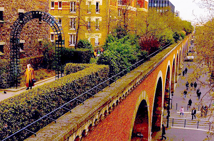
The Coulée Verte René Dumont, 4,5 km long (additional photos available here) was began in 1993 on the emplacement of an ancient rail line. The elevated part, pictured above, which runs along the Avenue Daumesnil, has beneath it 71 arcades are found artists' workshops and art and antique stores. On the roof above the arcades, and further along, at ground level, are found a succession of pretty flower gardens. Vou will come across new appartment buildings, unrestricted grass lawns, and playgrounds.
Coulée Verte René Dumont near east edge of Paris:
Next you visit a large part of the Bois de Vincennes, a very large park to the east of Paris. After your ride through the park, you have the option of shortening your trip by returning to the center of Paris using the bicycle path of the Marne and the Seine (about 19 kilometers - 12 miles inn total)).
"One of the riverside lane along the Marne River. Every so often barriers block through automobile traffic.
Continuing, after a few blocks of urban streets with separated bike lanes, you arrive at the beautiful Marne River. You follow the Marne for 14 kilometers on scenic riverside lanes with almost no traffic and then ride an additional 4 kilometers to a huge lake with grassy banks, used primarily for what the French call Aviron; (crew). It is about a 25 kilometer trip each way.
You may return to Paris the way you came; or by the the Marne and Seine bicycle paths or by the Canal de l;Ourcq. The Ourcq Canal alternative (which entails altogether a 70 kilometer ride) makes for a long but interesting day — in my opinion the very best day circuit both leaving and returning to Paris by bike. The route between the Marne and the Ourcq passes through towns, sleepy villages, forests, and a bit of farmland.
Directions to Cycle from Paris along the Marne, and to continue to the Canal de l'Ourcq:
To print the itinerary, select the text below,
and choose print selection.
From the Bastille, ride southeast (with the Opera of the Bastille on your left) on Rue de Lyon (bike-bus lane) for 250 m, past where the road forks left. At the traffic light, cross to the left following the bicycle markings, continue in the same direction as before besides a traffic island on your left, and then going left around the island and right onto Avenue Daumesnil. Your bike lane runs on the
right side of the street (behind a little barrier), against traffic, with its own stoplights; use great care in crossing these intersections, where oncoming vehicles often turn accross your path. On
your left of Avenue Daumesnil, there is a series of similar buildings containg mainly art studios, with,
on the roof, a walkway that crosses the streets below (this is called Coulée Verte René Dumont).A train line once ran
here.
If it is after 8:00 in the
morning on weekdays or 9am on weekends, and if you are willing to walk your bike for ten blocks,
the author recommends carrying your bike up four flights of stairs to the top of
the Coulée, above Avenue Daumesnil. You must walk your bicycle on the aerial walkway —
which is lined with flowers and which has many interesting views. The Coulée Verte runs for 1 kilometer and leads to an attractive
footbridge over a playground, amidst an apartment complex, and then
directly into the bike path at the Allée Vivaldi.
If you decide, rather to stay in the bicycle lane on Avenue Daumesnil, after the end of the viaduct, the major street, Rue de Charenton crosses Avenue Daumesnil at a sharp angle and you pass the Mairie (city hall) of the 12th Arrondissement on your right. If it is after 8:00 AM (9:00 on weekends) one block afrer Rue de Charenton, and if it is after the opening hours mentioned above, turn left onto Rue Henard (sign: "Jardin de Reuilly") and right at the next intersection onto the Allée Vivaldi.
Follow the bike path along the Allée Vivaldi past a gate through the tunnel,
and then along the Coulée Verte René Dumont. Pay careful attention to the
bike path signs, to avoid the pedestrian paths, as you wind among
the flowers and plants.
At the end of the Coulée Verte René Dumont, follow the bikeway up a little hill, through the gate; it then turns right, downhill, then left after two blocks and passes under the Périphérique Highway. Turn right (south), and continue following the bike path beside the Boulevard de la Guyane to the Bois de Vincennes. Cross the road at the traffic light in front of Lake Daumesnil..
If it is before 8:00 AM the gates to the Coulée Verte Rene Dumont will be locked, and you will have to miss it. Or perhaps you will prefer to take the fastest route out of Paris. If so, simply continue southeast on Avenue de Daumesnil until the Lac (lake) Dausmenil in the Bois de Vincennes.
No matter how you have come to this intersection,either follow Avenue de Daumesnil east for one block (bike lane) and turn right on the Rue de Ceinture de Lac Daumesnil, continuing to the first traffic light at an intersection; or walk or ride
your bike to and eastward along Lake Daumesnil on the right, bearing left to exit back to the
road just before the lake ends (where the shore curves
sharply right). At this point there is a complex intersection with two lights (see the photo below). Just to the south of the first light, where the path comes out from the lake just north of where the two roads meet, cross the road using the three pedestrian crossings, go south a short distance and turn left (or one if you exit just south of this, cross and continue straight). Turn left (towards the north) on the Rue de Batteries. This "road" curves gradually to the right.
When the Route Des Batteries starts to curve left after 300 meters (0.2 mi), you come to some barriers and a road that angles sharply to the right, which you should not take. Assuming that you wish to take the shortest and quickest route,
and that your bike can handle a fairly wide dirt path (the
only paved segment of this trip), proceed as follows: At the junction with the road branch right onto the dirt path, usually behind a
barrier, called the Avenue Des Tribunes. Pass by two different dirt cross paths. In 600 meters (0.3 - 0.4 mi), after a big open space, turn right
into the paved Route de Tourelles.
If you want to avoid the gravel path I've just described, branch left to stay on the Route des
Batteries as it curves left. Cross any roads or paths that come at right angles. The second road merginging in from
the right (in 500 m - 0.3 mi) is the Route de la Tourelles. Make a
very sharp right turn (almost a u-turn) into this and follow it
southwards. (This routing adds about 600 meters to your ride.)
In either case, follow the Route de la Tourelles to the southeast corner of the
Bois de Vincennes.
Directions for Short Loop bikeroute back to Paris:
(After the road has curved left and is going
mainly eastward, just before the barrier you will see a sign, sharply to the right, indicating a bicycle route to
the Marne River. "Bords de Marne" If you wish to return to Paris follow all the signs. You will cross the Avenue de Gravelle at a light, then go to the left (east) along the far side of it, then descend on the Route des Barrières (closed to motor traffic- sign for Marne). For the fastest route, branch off this to the right. Whether you go right or straight you will come out on Rue du Maréchal Leclerc. Turn right (west and ride on the bike path for a distance to where it ends at a major crosswalk that leads south into a gap in the buildings and to a pedestrian bridge ("paserelle") that comes to the Chemin de Halage Bikepath back to the center of Paris.
Continuation of the outbound Marne River Bicycle Route:
Continuing on the Marne-Canal de Route, past the barrier across the Route de la Tourelles you may encounter a little light traffic. There is a narrow dirt path on the right. With
the hippodrome on your left, and just after the little lake on your
right, bear right to exit the Bois.
Continue eastward on a wide road (Avenue de Gravelle in light traffic), pass over the freeway. At the next intersection with a major highway, where the bike path turns left, take the crosswalk across the highway to continue straight, downhill on a bike path. Do not bear left at the first intersection; rather continue straight on the bike path. At the next intersection, D148 follow the bike path to the left. (Sign saying pedestrians have priority.) In two blocks the bikepath curves left. You must not follow the bikepath under the bridge; use the sidewalk to go up to the overpass. Turn right and cycle on the bike path across the bridge, the Pont de Joinville. After the bridge, when possible, turn right very sharply (180 degrees), backtracking
to the riverside. Turn right.
The
Marne River:
If you have a bicycle computer, note your reading.
Head north under the bridge, on an almost traffic-free suburban
lane along the Marne River. Auto barriers every few kilometers
eliminate through traffic. The Marne soon turns east. You will
follow the lane along the south side of the Marne
for 14 kilometers (about 8 miles) - a very pretty ride indeed.
Houses along Marne:
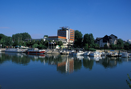
Hotel along Marne with Marina
Sidewalk by Chez Gengene:
Houseboat on the Maßrne River:
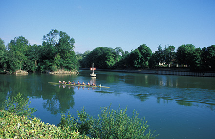
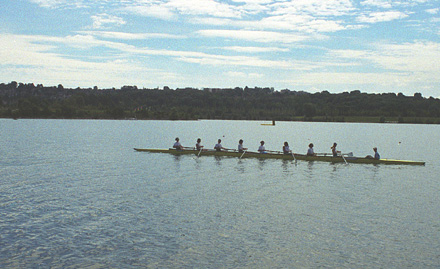
A shell cruises on the Marne:
If you dont have a bike computer, keep track as follows: You start from the bridge with the Marne going north, then it turns east, turns north,turns east, turns north for again and then east (3 times north and east).
In the town of Gournay-sur-Marne (after the sinuous river has once again curved sharply back to the east and you cross under a bridge at kilometer 13. Continue along the Marne for another 900 meters (0.5 mi) to a pedestrian bridge.
Take the
pedestrian bridge over the Marne to an island that lies between the Marne and a canal. Turn right and continue on the south-facing bank of this island in the
same direction as before, eventually passing a horse pasture, until the very
end, about 2 kilometers. Walk your bike through the small gap in the poles into the park of the Nautical Basin of Vaires. Ride around the lake in a clockwise direction.
The Nautical Basin of Vaires is the end of this Route, unless you are going to ride the link to Route 1 described below. It is a huge, attractive,
open park with a two kilometers-long lake — used by the French national
aviron (crew) teams to train. If you are
lucky you will see some racing shells. You may stop for lunch or
a picnic near the athletic club at the far end; the grass is soft,
and there is a nice view of the water. Or you may eat at the club's
snack bar (if you did not bring a sandwich). The snack bar also has a wash room.
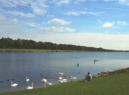
Swans in the Nautical Basin of Vaires.
Aviron in the Nautical Basin of Vaires:
Snack bar and bathroom beside indoor racket courts.
Return to Paris or Continuation:
To return directly to Paris, you may (1) backtrack the way
you came — about 30 kilometers; or (2) backtrack as far as the Pont
de Joinville bridge over the Marne, and take the bicycle paths of the close Marne and the Seine back to central Paris, about 30 kilometers.
Or.(3) What I always have done, you may continue, with a longer circuit that leads
back to Paris via low traffic roads through towns, a village, the
countryside, and the Ourcq canal — about 36 kilometers from the Athletic Club at Vaires to the Bastille or to Notre Dame .
(1) If backtracking the way you came, when you arrive at Joinville-le-Pont
just before the big bridge, turn left, then 180 degrees right, to
gain the bridge. After crossing this, follow in reverse the way you came.
(2) For variety and a shortcut (in time and distance), you can link to the close-in bicycle paths along the Marne and Seine. To do so, after crossing
the Marne by the Pont de Joinville, turn left immediately following the way you came. This curves right. After this, DO NOT turn right again (as you came) but stay straight and turn right at the next intersection onto a bicycle path (signs Saint-Maurice, Maire Annex). Immediately turn very sharp left and follow this narrow lane around two right turns, then past tennis courts. Before the parking lot turn left and immediately right onto the bike path towards Paris.
Directions for the Marne
to Ourcq Loop:
If you have decided to take the longer loop ride via the Ourcq, continue
east from the athletic club (away from Paris), existing the grounds on
a driveway that turns north. You will exit through a gate. At the
traffic circle follow the bike path on the left to cross the canal bridge.
After the bridge, at the small traffic circle bear right to stay on the the Rue de Torcy
(heading northeast at a 45 degree angle from the bridge) and keep riding in the same direction,
through two jogs (bear left, then right each time). The road becomes
the Chemin de Gué de Launay (bike lanes begin but soon end). After crossing a rail bridge (the main rail line from Paris to Strasbourg), you will reach,
at a traffic circle, an important highway (D934).
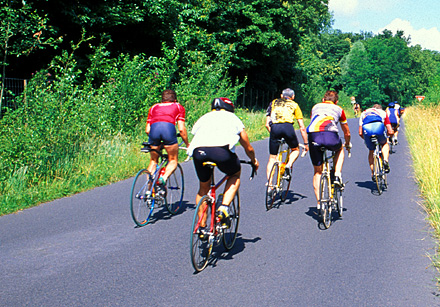
Cyclists on an outing near Pomponnette:
At the traffic circle, turn right (bike lane), go only 150 meters
(0.1 mi) along this major road, then turn left (cross the traffic lanes carefully) at the sign for Pomponnette
onto a very calm road (rue de la Libération). Turn left when possible, heading straight
north (Chemin des Grès). The street merges with Rue de Villevaudé, and curves left.
At the dead end turn right (north) at Route de Brou, cross the bridge over the superhighway,
and at the next highway (Route de Lagny; cross very carefully. Continue
(the road is now called rue Fréderic Lève) on a minor road, bearing left up a long hill (the
only one on this circuit - the street is now called Grande Rue) into Villevaudé. The street curves right (north).
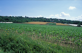
Cornfields near Villevaudé:
After the village, when the street ends at a highway, turn left for
one block to the traffic circle. Cross D34, taking the second exit onto D105 to the
northwest through fields, then trees, first slightly uphill, then
steeply downhill (light-moderate traffic).
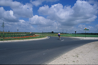
Cyclist at Rond-point (rotary) near the high point between
the Marne and the Ourcq Canal:
Cross under the superhighway; at the traffic circle continue straight (second exit, Route de Villevaudé,
pass under a highway, then, immediately, when your road makes a right turn, bear left. At the light in 200 meters, turn
right (north) onto Rue de la République,Cultural Jacques Prevert, which, slightly right at a cross street, becomes Avenue General De Gaulle (light traffic). The
continual downhill grade takes you north and northwest through the
town of Villeparasis (very light traffic).
When this comes to the traffic circle by the school, turn left (second exit) and immediately right
(keeping the school on your right) - arrow: "Le Marché.
After 1.2 km (0.7 mi), go straight towards the buildings in the bus area and bear left. Markets take place here Wednesday, Fridday and Sunday mornings from 8:00 to 12:00. Immediately after the buildings there is a gap in the fence on the right. Turn right here and ride in one block, then turn left (before the bridge) and ride down to the bike path of the canal de l'Ourcq towards Paris.
The Ourcq Canal Back
to Paris:
When riding the Ourcq bicycle path in the westerly direction, ride slowly down the steeper inclines. Along the south bank, always choose to ride to the left, up on the hill; the pedestrian path (tow path) goes straight ahead by the canal.
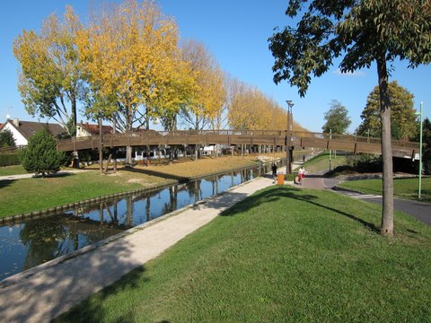
Canal and bike path, Aulnay-sous-Bois.
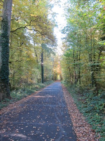
The path turns moderately left into the forest.
The Sevran forest.
At the end of the forest entrance path, you turn right, parallel to the canal, and at the end of this you turn right again to regain the Canal.
Eventually you cross to the right (north) side of the canal. Possibly you will be detoured to the right away from the canal, and follows roughly beside a rail yard for a kilomèter, before a left turn brings you back to waterside. You might wish to walk your bike over a few short sections with rough pavement. Close to Paris, you cross back to sthe left (south) bank. You pass under the highway and enter the Vilette Park.
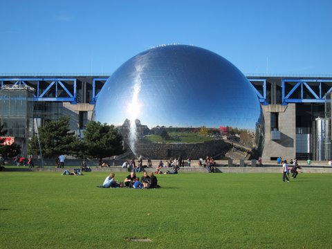
The Geode, in front of the Science Museum, in the
Villette Park.
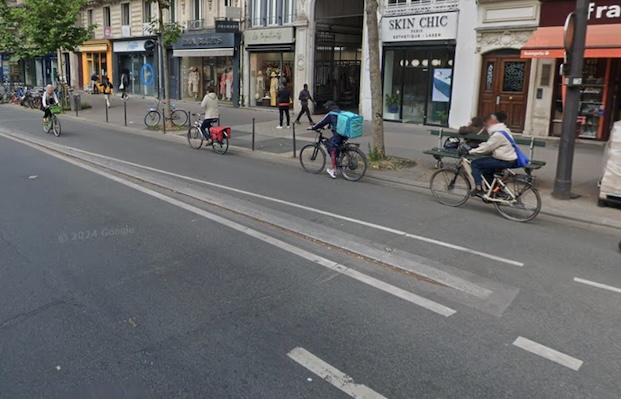
In Paris, after passing the Géode ball, in the Villette Park, stay close to the water, keeping straight, along the canal. Follow the bike path, beside the street (with one jog to left and right), until it ends, at complicated multi-street intersection with an elevated metro line. Here you need to pick up the bike lane on the street on the west (right) side of the Canal Saint Martin that lies more or less in a direct line from where you were coming.
To do so you I suggest that you walk your bike left in the crosswalk, then right to the canal, and across the canal to the west where a bike lane is on the right side of the street. The Canal St. Martin bike lane, first on the right, then on the left, leads to the Bastille. (Be very careful in this lane of obstructions and careless pedestrians.) Near the Bastille, on Boulevard Richard Lenoir, an outdoor market takes place on Thursday and Saturday from early morning until mid afternoon. The street is clogged, so you will either need to walk your bicycle, or take the alternative route to central Paris, described below, which, although it departs from the canal, appears to be safer and easier:
Alternative Route to Central Paris: At the start of the canal bike lane after the multi-street intersection take rue LaFayette that angles to the right (bike lanes on right). In two blocks bear left onto Rue du Chateau Landon (bike lanes on right). In two blocks cross right to join the bike lanes on the right of Rue du Faubourg Saint-Martin. This will curve to the right to pass in front of the Gare de l'Est. Cross left at the second street (very wide witha square in the middle) to a two-way bike lane on the left side. In a few blocks this crosses to the right side.
Bike lanes on Boulevard Sébastropol
Follow the Boulevard de Sébastropol bike lanes south to Chatelet and the Île de la Cité or beyond.
From the Bastille, ride southeast (with the Opera of the Bastille on your left) on Rue de Lyon (bike-bus lane) for 250 m, past where the road forks left. At the traffic light, cross to the left following the bicycle markings, continue in the same direction as before besides a traffic island on your left, and then going left around the island and right onto Avenue Daumesnil. Your bike lane runs on the
right side of the street (behind a little barrier), against traffic, with its own stoplights; use great care in crossing these intersections, where oncoming vehicles often turn accross your path. On
your left of Avenue Daumesnil, there is a series of similar buildings containg mainly art studios, with,
on the roof, a walkway that crosses the streets below (this is called Coulée Verte René Dumont).A train line once ran
here.
If it is after 8:00 in the
morning on weekdays or 9am on weekends, and if you are willing to walk your bike for ten blocks,
the author recommends carrying your bike up four flights of stairs to the top of
the Coulée, above Avenue Daumesnil. You must walk your bicycle on the aerial walkway —
which is lined with flowers and which has many interesting views. The Coulée Verte runs for 1 kilometer and leads to an attractive
footbridge over a playground, amidst an apartment complex, and then
directly into the bike path at the Allée Vivaldi.
If you decide, rather to stay in the bicycle lane on Avenue Daumesnil, after the end of the viaduct, the major street, Rue de Charenton crosses Avenue Daumesnil at a sharp angle and you pass the Mairie (city hall) of the 12th Arrondissement on your right. If it is after 8:00 AM (9:00 on weekends) one block afrer Rue de Charenton, and if it is after the opening hours mentioned above, turn left onto Rue Henard (sign: "Jardin de Reuilly") and right at the next intersection onto the Allée Vivaldi.
Follow the bike path along the Allée Vivaldi past a gate through the tunnel,
and then along the Coulée Verte René Dumont. Pay careful attention to the
bike path signs, to avoid the pedestrian paths, as you wind among
the flowers and plants.
At the end of the Coulée Verte René Dumont, follow the bikeway up a little hill, through the gate; it then turns right, downhill, then left after two blocks and passes under the Périphérique Highway. Turn right (south), and continue following the bike path beside the Boulevard de la Guyane to the Bois de Vincennes. Cross the road at the traffic light in front of Lake Daumesnil..
If it is before 8:00 AM the gates to the Coulée Verte Rene Dumont will be locked, and you will have to miss it. Or perhaps you will prefer to take the fastest route out of Paris. If so, simply continue southeast on Avenue de Daumesnil until the Lac (lake) Dausmenil in the Bois de Vincennes.
No matter how you have come to this intersection,either follow Avenue de Daumesnil east for one block (bike lane) and turn right on the Rue de Ceinture de Lac Daumesnil, continuing to the first traffic light at an intersection; or walk or ride
your bike to and eastward along Lake Daumesnil on the right, bearing left to exit back to the
road just before the lake ends (where the shore curves
sharply right). At this point there is a complex intersection with two lights (see the photo below). Just to the south of the first light, where the path comes out from the lake just north of where the two roads meet, cross the road using the three pedestrian crossings, go south a short distance and turn left (or one if you exit just south of this, cross and continue straight). Turn left (towards the north) on the Rue de Batteries. This "road" curves gradually to the right.
When the Route Des Batteries starts to curve left after 300 meters (0.2 mi), you come to some barriers and a road that angles sharply to the right, which you should not take. Assuming that you wish to take the shortest and quickest route,
and that your bike can handle a fairly wide dirt path (the
only paved segment of this trip), proceed as follows: At the junction with the road branch right onto the dirt path, usually behind a
barrier, called the Avenue Des Tribunes. Pass by two different dirt cross paths. In 600 meters (0.3 - 0.4 mi), after a big open space, turn right
into the paved Route de Tourelles.
If you want to avoid the gravel path I've just described, branch left to stay on the Route des
Batteries as it curves left. Cross any roads or paths that come at right angles. The second road merginging in from
the right (in 500 m - 0.3 mi) is the Route de la Tourelles. Make a
very sharp right turn (almost a u-turn) into this and follow it
southwards. (This routing adds about 600 meters to your ride.)
In either case, follow the Route de la Tourelles to the southeast corner of the
Bois de Vincennes.
Directions for Short Loop bikeroute back to Paris:
(After the road has curved left and is going
mainly eastward, just before the barrier you will see a sign, sharply to the right, indicating a bicycle route to
the Marne River. "Bords de Marne" If you wish to return to Paris follow all the signs. You will cross the Avenue de Gravelle at a light, then go to the left (east) along the far side of it, then descend on the Route des Barrières (closed to motor traffic- sign for Marne). For the fastest route, branch off this to the right. Whether you go right or straight you will come out on Rue du Maréchal Leclerc. Turn right (west and ride on the bike path for a distance to where it ends at a major crosswalk that leads south into a gap in the buildings and to a pedestrian bridge ("paserelle") that comes to the Chemin de Halage Bikepath back to the center of Paris.
Continuation of the outbound Marne River Bicycle Route:
Continuing on the Marne-Canal de Route, past the barrier across the Route de la Tourelles you may encounter a little light traffic. There is a narrow dirt path on the right. With
the hippodrome on your left, and just after the little lake on your
right, bear right to exit the Bois.
Continue eastward on a wide road (Avenue de Gravelle in light traffic), pass over the freeway. At the next intersection with a major highway, where the bike path turns left, take the crosswalk across the highway to continue straight, downhill on a bike path. Do not bear left at the first intersection; rather continue straight on the bike path. At the next intersection, D148 follow the bike path to the left. (Sign saying pedestrians have priority.) In two blocks the bikepath curves left. You must not follow the bikepath under the bridge; use the sidewalk to go up to the overpass. Turn right and cycle on the bike path across the bridge, the Pont de Joinville. After the bridge, when possible, turn right very sharply (180 degrees), backtracking
to the riverside. Turn right.
The
Marne River:
If you have a bicycle computer, note your reading.
Head north under the bridge, on an almost traffic-free suburban
lane along the Marne River. Auto barriers every few kilometers
eliminate through traffic. The Marne soon turns east. You will
follow the lane along the south side of the Marne
for 14 kilometers (about 8 miles) - a very pretty ride indeed.
Houses along Marne:
Hotel along Marne with Marina
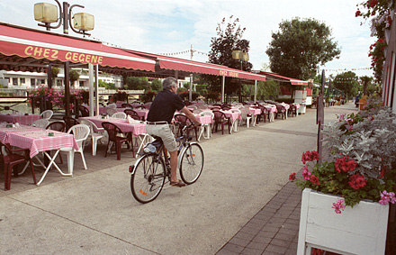
Sidewalk by Chez Gengene:
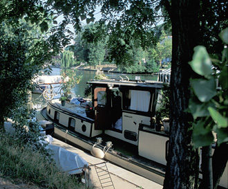
Houseboat on the Maßrne River:
A shell cruises on the Marne:
If you dont have a bike computer, keep track as follows: You start from the bridge with the Marne going north, then it turns east, turns north,turns east, turns north for again and then east (3 times north and east).
In the town of Gournay-sur-Marne (after the sinuous river has once again curved sharply back to the east and you cross under a bridge at kilometer 13. Continue along the Marne for another 900 meters (0.5 mi) to a pedestrian bridge.
Take the
pedestrian bridge over the Marne to an island that lies between the Marne and a canal. Turn right and continue on the south-facing bank of this island in the
same direction as before, eventually passing a horse pasture, until the very
end, about 2 kilometers. Walk your bike through the small gap in the poles into the park of the Nautical Basin of Vaires. Ride around the lake in a clockwise direction.
The Nautical Basin of Vaires is the end of this Route, unless you are going to ride the link to Route 1 described below. It is a huge, attractive,
open park with a two kilometers-long lake — used by the French national
aviron (crew) teams to train. If you are
lucky you will see some racing shells. You may stop for lunch or
a picnic near the athletic club at the far end; the grass is soft,
and there is a nice view of the water. Or you may eat at the club's
snack bar (if you did not bring a sandwich). The snack bar also has a wash room.
Swans in the Nautical Basin of Vaires.
Aviron in the Nautical Basin of Vaires:
Snack bar and bathroom beside indoor racket courts.
Return to Paris or Continuation:
To return directly to Paris, you may (1) backtrack the way
you came — about 30 kilometers; or (2) backtrack as far as the Pont
de Joinville bridge over the Marne, and take the bicycle paths of the close Marne and the Seine back to central Paris, about 30 kilometers.
Or.(3) What I always have done, you may continue, with a longer circuit that leads
back to Paris via low traffic roads through towns, a village, the
countryside, and the Ourcq canal — about 36 kilometers from the Athletic Club at Vaires to the Bastille or to Notre Dame .
(1) If backtracking the way you came, when you arrive at Joinville-le-Pont
just before the big bridge, turn left, then 180 degrees right, to
gain the bridge. After crossing this, follow in reverse the way you came.
(2) For variety and a shortcut (in time and distance), you can link to the close-in bicycle paths along the Marne and Seine. To do so, after crossing
the Marne by the Pont de Joinville, turn left immediately following the way you came. This curves right. After this, DO NOT turn right again (as you came) but stay straight and turn right at the next intersection onto a bicycle path (signs Saint-Maurice, Maire Annex). Immediately turn very sharp left and follow this narrow lane around two right turns, then past tennis courts. Before the parking lot turn left and immediately right onto the bike path towards Paris.
Directions for the Marne
to Ourcq Loop:
If you have decided to take the longer loop ride via the Ourcq, continue
east from the athletic club (away from Paris), existing the grounds on
a driveway that turns north. You will exit through a gate. At the
traffic circle follow the bike path on the left to cross the canal bridge.
After the bridge, at the small traffic circle bear right to stay on the the Rue de Torcy
(heading northeast at a 45 degree angle from the bridge) and keep riding in the same direction,
through two jogs (bear left, then right each time). The road becomes
the Chemin de Gué de Launay (bike lanes begin but soon end). After crossing a rail bridge (the main rail line from Paris to Strasbourg), you will reach,
at a traffic circle, an important highway (D934).
Cyclists on an outing near Pomponnette:
At the traffic circle, turn right (bike lane), go only 150 meters
(0.1 mi) along this major road, then turn left (cross the traffic lanes carefully) at the sign for Pomponnette
onto a very calm road (rue de la Libération). Turn left when possible, heading straight
north (Chemin des Grès). The street merges with Rue de Villevaudé, and curves left.
At the dead end turn right (north) at Route de Brou, cross the bridge over the superhighway,
and at the next highway (Route de Lagny; cross very carefully. Continue
(the road is now called rue Fréderic Lève) on a minor road, bearing left up a long hill (the
only one on this circuit - the street is now called Grande Rue) into Villevaudé. The street curves right (north).
Cornfields near Villevaudé:
After the village, when the street ends at a highway, turn left for
one block to the traffic circle. Cross D34, taking the second exit onto D105 to the
northwest through fields, then trees, first slightly uphill, then
steeply downhill (light-moderate traffic).
Cyclist at Rond-point (rotary) near the high point between
the Marne and the Ourcq Canal:
Cross under the superhighway; at the traffic circle continue straight (second exit, Route de Villevaudé,
pass under a highway, then, immediately, when your road makes a right turn, bear left. At the light in 200 meters, turn
right (north) onto Rue de la République,Cultural Jacques Prevert, which, slightly right at a cross street, becomes Avenue General De Gaulle (light traffic). The
continual downhill grade takes you north and northwest through the
town of Villeparasis (very light traffic).
When this comes to the traffic circle by the school, turn left (second exit) and immediately right
(keeping the school on your right) - arrow: "Le Marché.
After 1.2 km (0.7 mi), go straight towards the buildings in the bus area and bear left. Markets take place here Wednesday, Fridday and Sunday mornings from 8:00 to 12:00. Immediately after the buildings there is a gap in the fence on the right. Turn right here and ride in one block, then turn left (before the bridge) and ride down to the bike path of the canal de l'Ourcq towards Paris.
The Ourcq Canal Back
to Paris:
When riding the Ourcq bicycle path in the westerly direction, ride slowly down the steeper inclines. Along the south bank, always choose to ride to the left, up on the hill; the pedestrian path (tow path) goes straight ahead by the canal.
Canal and bike path, Aulnay-sous-Bois.
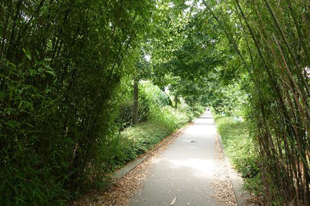
The path turns moderately left into the forest.
The Sevran forest.
At the end of the forest entrance path, you turn right, parallel to the canal, and at the end of this you turn right again to regain the Canal.
Eventually you cross to the right (north) side of the canal. Possibly you will be detoured to the right away from the canal, and follows roughly beside a rail yard for a kilomèter, before a left turn brings you back to waterside. You might wish to walk your bike over a few short sections with rough pavement. Close to Paris, you cross back to sthe left (south) bank. You pass under the highway and enter the Vilette Park.
The Geode, in front of the Science Museum, in the
Villette Park.
In Paris, after passing the Géode ball, in the Villette Park, stay close to the water, keeping straight, along the canal. Follow the bike path, beside the street (with one jog to left and right), until it ends, at complicated multi-street intersection with an elevated metro line. Here you need to pick up the bike lane on the street on the west (right) side of the Canal Saint Martin that lies more or less in a direct line from where you were coming.
To do so you I suggest that you walk your bike left in the crosswalk, then right to the canal, and across the canal to the west where a bike lane is on the right side of the street. The Canal St. Martin bike lane, first on the right, then on the left, leads to the Bastille. (Be very careful in this lane of obstructions and careless pedestrians.) Near the Bastille, on Boulevard Richard Lenoir, an outdoor market takes place on Thursday and Saturday from early morning until mid afternoon. The street is clogged, so you will either need to walk your bicycle, or take the alternative route to central Paris, described below, which, although it departs from the canal, appears to be safer and easier:
Alternative Route to Central Paris: At the start of the canal bike lane after the multi-street intersection take rue LaFayette that angles to the right (bike lanes on right). In two blocks bear left onto Rue du Chateau Landon (bike lanes on right). In two blocks cross right to join the bike lanes on the right of Rue du Faubourg Saint-Martin. This will curve to the right to pass in front of the Gare de l'Est. Cross left at the second street (very wide witha square in the middle) to a two-way bike lane on the left side. In a few blocks this crosses to the right side.
Bike lanes on Boulevard Sébastropol
Follow the Boulevard de Sébastropol bike lanes south to Chatelet and the Île de la Cité or beyond.
From the Bastille, ride southeast (with the Opera of the Bastille on your left) on Rue de Lyon (bike-bus lane) for 250 m, past where the road forks left. At the traffic light, cross to the left following the bicycle markings, continue in the same direction as before besides a traffic island on your left, and then going left around the island and right onto Avenue Daumesnil. Your bike lane runs on the right side of the street (behind a little barrier), against traffic, with its own stoplights; use great care in crossing these intersections, where oncoming vehicles often turn accross your path. On your left of Avenue Daumesnil, there is a series of similar buildings containg mainly art studios, with, on the roof, a walkway that crosses the streets below (this is called Coulée Verte René Dumont).A train line once ran here.
If it is after 8:00 in the morning on weekdays or 9am on weekends, and if you are willing to walk your bike for ten blocks, the author recommends carrying your bike up four flights of stairs to the top of the Coulée, above Avenue Daumesnil. You must walk your bicycle on the aerial walkway — which is lined with flowers and which has many interesting views. The Coulée Verte runs for 1 kilometer and leads to an attractive footbridge over a playground, amidst an apartment complex, and then directly into the bike path at the Allée Vivaldi.
If you decide, rather to stay in the bicycle lane on Avenue Daumesnil, after the end of the viaduct, the major street, Rue de Charenton crosses Avenue Daumesnil at a sharp angle and you pass the Mairie (city hall) of the 12th Arrondissement on your right. If it is after 8:00 AM (9:00 on weekends) one block afrer Rue de Charenton, and if it is after the opening hours mentioned above, turn left onto Rue Henard (sign: "Jardin de Reuilly") and right at the next intersection onto the Allée Vivaldi.
Follow the bike path along the Allée Vivaldi past a gate through the tunnel, and then along the Coulée Verte René Dumont. Pay careful attention to the bike path signs, to avoid the pedestrian paths, as you wind among the flowers and plants.
At the end of the Coulée Verte René Dumont, follow the bikeway up a little hill, through the gate; it then turns right, downhill, then left after two blocks and passes under the Périphérique Highway. Turn right (south), and continue following the bike path beside the Boulevard de la Guyane to the Bois de Vincennes. Cross the road at the traffic light in front of Lake Daumesnil..
If it is before 8:00 AM the gates to the Coulée Verte Rene Dumont will be locked, and you will have to miss it. Or perhaps you will prefer to take the fastest route out of Paris. If so, simply continue southeast on Avenue de Daumesnil until the Lac (lake) Dausmenil in the Bois de Vincennes.
No matter how you have come to this intersection,either follow Avenue de Daumesnil east for one block (bike lane) and turn right on the Rue de Ceinture de Lac Daumesnil, continuing to the first traffic light at an intersection; or walk or ride your bike to and eastward along Lake Daumesnil on the right, bearing left to exit back to the road just before the lake ends (where the shore curves sharply right). At this point there is a complex intersection with two lights (see the photo below). Just to the south of the first light, where the path comes out from the lake just north of where the two roads meet, cross the road using the three pedestrian crossings, go south a short distance and turn left (or one if you exit just south of this, cross and continue straight). Turn left (towards the north) on the Rue de Batteries. This "road" curves gradually to the right.
When the Route Des Batteries starts to curve left after 300 meters (0.2 mi), you come to some barriers and a road that angles sharply to the right, which you should not take. Assuming that you wish to take the shortest and quickest route, and that your bike can handle a fairly wide dirt path (the only paved segment of this trip), proceed as follows: At the junction with the road branch right onto the dirt path, usually behind a barrier, called the Avenue Des Tribunes. Pass by two different dirt cross paths. In 600 meters (0.3 - 0.4 mi), after a big open space, turn right into the paved Route de Tourelles.
If you want to avoid the gravel path I've just described, branch left to stay on the Route des Batteries as it curves left. Cross any roads or paths that come at right angles. The second road merginging in from the right (in 500 m - 0.3 mi) is the Route de la Tourelles. Make a very sharp right turn (almost a u-turn) into this and follow it southwards. (This routing adds about 600 meters to your ride.)
In either case, follow the Route de la Tourelles to the southeast corner of the Bois de Vincennes.
Directions for Short Loop bikeroute back to Paris:
(After the road has curved left and is going mainly eastward, just before the barrier you will see a sign, sharply to the right, indicating a bicycle route to the Marne River. "Bords de Marne" If you wish to return to Paris follow all the signs. You will cross the Avenue de Gravelle at a light, then go to the left (east) along the far side of it, then descend on the Route des Barrières (closed to motor traffic- sign for Marne). For the fastest route, branch off this to the right. Whether you go right or straight you will come out on Rue du Maréchal Leclerc. Turn right (west and ride on the bike path for a distance to where it ends at a major crosswalk that leads south into a gap in the buildings and to a pedestrian bridge ("paserelle") that comes to the Chemin de Halage Bikepath back to the center of Paris.
Continuation of the outbound Marne River Bicycle Route:
Continuing on the Marne-Canal de Route, past the barrier across the Route de la Tourelles you may encounter a little light traffic. There is a narrow dirt path on the right. With the hippodrome on your left, and just after the little lake on your right, bear right to exit the Bois.
Continue eastward on a wide road (Avenue de Gravelle in light traffic), pass over the freeway. At the next intersection with a major highway, where the bike path turns left, take the crosswalk across the highway to continue straight, downhill on a bike path. Do not bear left at the first intersection; rather continue straight on the bike path. At the next intersection, D148 follow the bike path to the left. (Sign saying pedestrians have priority.) In two blocks the bikepath curves left. You must not follow the bikepath under the bridge; use the sidewalk to go up to the overpass. Turn right and cycle on the bike path across the bridge, the Pont de Joinville. After the bridge, when possible, turn right very sharply (180 degrees), backtracking to the riverside. Turn right.
The Marne River:
If you have a bicycle computer, note your reading. Head north under the bridge, on an almost traffic-free suburban lane along the Marne River. Auto barriers every few kilometers eliminate through traffic. The Marne soon turns east. You will follow the lane along the south side of the Marne for 14 kilometers (about 8 miles) - a very pretty ride indeed.
Houses along Marne:
Hotel along Marne with Marina
Sidewalk by Chez Gengene:
Houseboat on the Maßrne River:
A shell cruises on the Marne:
If you dont have a bike computer, keep track as follows: You start from the bridge with the Marne going north, then it turns east, turns north,turns east, turns north for again and then east (3 times north and east).
In the town of Gournay-sur-Marne (after the sinuous river has once again curved sharply back to the east and you cross under a bridge at kilometer 13. Continue along the Marne for another 900 meters (0.5 mi) to a pedestrian bridge.
Take the pedestrian bridge over the Marne to an island that lies between the Marne and a canal. Turn right and continue on the south-facing bank of this island in the same direction as before, eventually passing a horse pasture, until the very end, about 2 kilometers. Walk your bike through the small gap in the poles into the park of the Nautical Basin of Vaires. Ride around the lake in a clockwise direction.
The Nautical Basin of Vaires is the end of this Route, unless you are going to ride the link to Route 1 described below. It is a huge, attractive, open park with a two kilometers-long lake — used by the French national aviron (crew) teams to train. If you are lucky you will see some racing shells. You may stop for lunch or a picnic near the athletic club at the far end; the grass is soft, and there is a nice view of the water. Or you may eat at the club's snack bar (if you did not bring a sandwich). The snack bar also has a wash room.
Swans in the Nautical Basin of Vaires.
Aviron in the Nautical Basin of Vaires:
Snack bar and bathroom beside indoor racket courts.
Return to Paris or Continuation:
To return directly to Paris, you may (1) backtrack the way you came — about 30 kilometers; or (2) backtrack as far as the Pont de Joinville bridge over the Marne, and take the bicycle paths of the close Marne and the Seine back to central Paris, about 30 kilometers. Or.(3) What I always have done, you may continue, with a longer circuit that leads back to Paris via low traffic roads through towns, a village, the countryside, and the Ourcq canal — about 36 kilometers from the Athletic Club at Vaires to the Bastille or to Notre Dame .
(1) If backtracking the way you came, when you arrive at Joinville-le-Pont just before the big bridge, turn left, then 180 degrees right, to gain the bridge. After crossing this, follow in reverse the way you came.
(2) For variety and a shortcut (in time and distance), you can link to the close-in bicycle paths along the Marne and Seine. To do so, after crossing the Marne by the Pont de Joinville, turn left immediately following the way you came. This curves right. After this, DO NOT turn right again (as you came) but stay straight and turn right at the next intersection onto a bicycle path (signs Saint-Maurice, Maire Annex). Immediately turn very sharp left and follow this narrow lane around two right turns, then past tennis courts. Before the parking lot turn left and immediately right onto the bike path towards Paris.
Directions for the Marne to Ourcq Loop:
If you have decided to take the longer loop ride via the Ourcq, continue
east from the athletic club (away from Paris), existing the grounds on
a driveway that turns north. You will exit through a gate. At the
traffic circle follow the bike path on the left to cross the canal bridge.
After the bridge, at the small traffic circle bear right to stay on the the Rue de Torcy (heading northeast at a 45 degree angle from the bridge) and keep riding in the same direction, through two jogs (bear left, then right each time). The road becomes the Chemin de Gué de Launay (bike lanes begin but soon end). After crossing a rail bridge (the main rail line from Paris to Strasbourg), you will reach, at a traffic circle, an important highway (D934).
Cyclists on an outing near Pomponnette:
At the traffic circle, turn right (bike lane), go only 150 meters (0.1 mi) along this major road, then turn left (cross the traffic lanes carefully) at the sign for Pomponnette onto a very calm road (rue de la Libération). Turn left when possible, heading straight north (Chemin des Grès). The street merges with Rue de Villevaudé, and curves left. At the dead end turn right (north) at Route de Brou, cross the bridge over the superhighway, and at the next highway (Route de Lagny; cross very carefully. Continue (the road is now called rue Fréderic Lève) on a minor road, bearing left up a long hill (the only one on this circuit - the street is now called Grande Rue) into Villevaudé. The street curves right (north).
Cornfields near Villevaudé:
After the village, when the street ends at a highway, turn left for one block to the traffic circle. Cross D34, taking the second exit onto D105 to the northwest through fields, then trees, first slightly uphill, then steeply downhill (light-moderate traffic).
Cyclist at Rond-point (rotary) near the high point between
the Marne and the Ourcq Canal:
Cross under the superhighway; at the traffic circle continue straight (second exit, Route de Villevaudé, pass under a highway, then, immediately, when your road makes a right turn, bear left. At the light in 200 meters, turn right (north) onto Rue de la République,Cultural Jacques Prevert, which, slightly right at a cross street, becomes Avenue General De Gaulle (light traffic). The continual downhill grade takes you north and northwest through the town of Villeparasis (very light traffic).
When this comes to the traffic circle by the school, turn left (second exit) and immediately right (keeping the school on your right) - arrow: "Le Marché. After 1.2 km (0.7 mi), go straight towards the buildings in the bus area and bear left. Markets take place here Wednesday, Fridday and Sunday mornings from 8:00 to 12:00. Immediately after the buildings there is a gap in the fence on the right. Turn right here and ride in one block, then turn left (before the bridge) and ride down to the bike path of the canal de l'Ourcq towards Paris.
The Ourcq Canal Back to Paris:
When riding the Ourcq bicycle path in the westerly direction, ride slowly down the steeper inclines. Along the south bank, always choose to ride to the left, up on the hill; the pedestrian path (tow path) goes straight ahead by the canal.
Canal and bike path, Aulnay-sous-Bois.
The path turns moderately left into the forest.
The Sevran forest.
At the end of the forest entrance path, you turn right, parallel to the canal, and at the end of this you turn right again to regain the Canal.
Eventually you cross to the right (north) side of the canal. Possibly you will be detoured to the right away from the canal, and follows roughly beside a rail yard for a kilomèter, before a left turn brings you back to waterside. You might wish to walk your bike over a few short sections with rough pavement. Close to Paris, you cross back to sthe left (south) bank. You pass under the highway and enter the Vilette Park.
The Geode, in front of the Science Museum, in the
Villette Park.
In Paris, after passing the Géode ball, in the Villette Park, stay close to the water, keeping straight, along the canal. Follow the bike path, beside the street (with one jog to left and right), until it ends, at complicated multi-street intersection with an elevated metro line. Here you need to pick up the bike lane on the street on the west (right) side of the Canal Saint Martin that lies more or less in a direct line from where you were coming.
To do so you I suggest that you walk your bike left in the crosswalk, then right to the canal, and across the canal to the west where a bike lane is on the right side of the street. The Canal St. Martin bike lane, first on the right, then on the left, leads to the Bastille. (Be very careful in this lane of obstructions and careless pedestrians.) Near the Bastille, on Boulevard Richard Lenoir, an outdoor market takes place on Thursday and Saturday from early morning until mid afternoon. The street is clogged, so you will either need to walk your bicycle, or take the alternative route to central Paris, described below, which, although it departs from the canal, appears to be safer and easier:
Alternative Route to Central Paris: At the start of the canal bike lane after the multi-street intersection take rue LaFayette that angles to the right (bike lanes on right). In two blocks bear left onto Rue du Chateau Landon (bike lanes on right). In two blocks cross right to join the bike lanes on the right of Rue du Faubourg Saint-Martin. This will curve to the right to pass in front of the Gare de l'Est. Cross left at the second street (very wide witha square in the middle) to a two-way bike lane on the left side. In a few blocks this crosses to the right side.
Bike lanes on Boulevard Sébastropol
Follow the Boulevard de Sébastropol bike lanes south to Chatelet and the Île de la Cité or beyond.