Europe Bicycle Touring
All rights reserved ©2001-2012
Trips June 2000, June 2008

To List of Great European Bike Tours

Home Page

By David May

Bicycle the North Sea Cycle Route, LF1, in France, Belgium, and the Netherlands

Cycle 450 kilometers (270 miles) along quiet roads, dikes and bike paths, often in view of the North Sea, on your self-organized biking tour.


Bike Rating: Excellent

Nature of the North Sea Bicycle Route: The North Sea Route traverses lands along and near the North Sea that are seldom visited by English and American tourists (except for the town of Bruges and the WWI and WWII battle zones). The route begins in Boulogne-sur-Mer — an interesting city on the English Channel about 45 miles (75 kilometers) south of the North Sea, and then passes through northernmost France, Belgian Flanders, Zeeland (i.e., Sea-land) province of the Netherlands, and Holland. It totals in length almost 300 miles (500 kilometers). The ending of this route occurs in the northernmost island of Holland, but nothing stops the cyclist from continuing on intoGermany, Denmark and Norway along the North Sea, and then, after a ferry ride, continues down through Scotland and England to the coast opposite Boulogne-sue-Mer, a 3,600 mile (6,000 kilometer) circuit that goes by the name North Sea Cycle Route.

I give this route a high rating because you bicycle in several types of terrain; because you visit several patterns of habitation and agriculture in three different nations; because you peddle by or through beautiful sand dunes and beaches, and across broad estuaries on miles-long mechanical dikes***; because you ride some ferries; and because you visit numerous very pretty and interesting towns and cities, of which two are astonishingly world class: Bruges (Brugge), Belgium***, and (after the official Route is over) Amsterdam***.

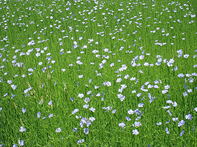
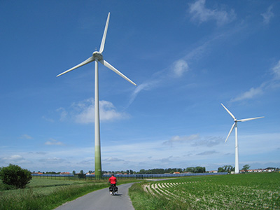
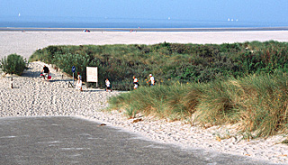
Below: North Sea Beach in Zeeland.

Beach in Zeeland, NetherlandsExcept for the centers of the more importat towns, there is a certain starkness to most of this voyage: a duller light, monotonal greens, browns and beiges, simple buildings, few signs of wealth or importance. It is a far cry from the brightness of Provence or the showiness of the Danube or Alsace Wine Route. You feel the dominance of the cold North Sea, of the winds, of the weather. Yet, I went back to ride this route only a few years after my original trip. There is something compelling in the forces of nature, intersperced with occasional artistic highs.


Difficulty:

This trip can be relatively easy or difficult, depending upon the weather. If you are an easy-going biker, I recommend this trip only if you are allowing extra days to wait out the winds and the weather, or to ride short segments. You can run into fierce winds against you in the flatlands or along the North Sea with little, if any, protection against them. In discussing the wind, one Belgian bicycle shop owner put it this way: Tthe winds are our mountains and they make cycling interesting". However, unlike mountains where you always ride both up and down, your trip conveivably could always be against the wind.  The prevailing winds , on the other hand, are usually behind or to the side, so if you ride short stages or wait it out, the wind should shift in your favor.

On the first trip I made—hard but enjoyable—I fought a 20 mph headwind for several days in a row (but was lucky to have no rain). On the second trip, in contrast, the winds were mainly lateral or even from behind, the sky was sunny, and the cycling was relatively easy.  The second trip actually was a substitution for a planned trip in the south of France, which had unexpectly stormy weather.  I knew that the long-range forecast for Northern France, Belgium and the Netherlands was for sunny, mild weather.  Again, check the forecast before you come, or allow extra days.

As to the difficulty of the terrain, at the beginning of the ride, near Boulogne, you will experience rolling terrain with a couple of climbs -- nothing too difficult. After the first 70 kilometers, you approach and enter Flanders—the "flat country" immortalized by the song of Jacques Brel. The terrain becomes, in fact, nearly flat, until you reach the small dunes along the Holland shore.

Traffic and Pavement Quality:

The North Sea Route rarely encounters any traffic at all. The exceptions would be in Boulogne-sur-Mer, where you can walk your bike on sidewalks, in Bruges, where hundreds of bicycles mingle with the relatively light traffic, and in bike lanes along busy streets in The Hague (where there are sidewalks as an alternative).

The road surfaces you will ride on vary considerably: In France there are two Departments along the route, and the first, Pas-de-Calais has very uneven, even bumpy, back roads that will slow you down by a third or more. The other Department, Nord, has much better roads, but will still slow your riding speed by perhaps 15%. In Belgium, by and large, the roads and bike paths are smooth and fast going. Ridding in the Neatherlands is mainly on smooth roads or on bike paths. The bike paths vary considerably, from very smooth high speed ones, to bumpy slow ones, to even slower ones using paving stones of various sizes and evenness amongst the Holland dunes. You should not plan to cover the same ground in France, or along the Holland dunes, that you would on a smooth highway. In order to avoid using wider tires or save time, you might want to bike on the roads alongside the dunes. However, with 700 28C tires and a thirty pound load, and only occasionally walking my bicycle, I was able to utilize the dune bike paths.

Finding Your Way:

Typically, on the North Sea Cycle Route you do not follow your own trip routing, but rather a waymarked or signposted route, the LF1, the "Route de la Mer du Nord" in French or "Nordzee Fiets Route" in Flemish, that has been laid out by local organizations, working with regional authorities to create a seamless whole. To the author, the guiding principle of the waymarking seems to have been to avoid traffic while visiting interesting sights of nature. The route normally skirts towns, and if you enjoy visiting towns, you should by all means deviate occasionally from the officially marked route. For the author these deviations really improved the pleasure of the ride. Towns especially worth visiting are cited in the trip details below.

All turns on the route are supposed to be marked by signposts that bear the name "LF1" or "Noordzee Route" or "Nordzee Fietsroute" (in Flemish) or "Route de la Mer du Nord"( in French). Sometimes the "LF" is followed by an "a", which means the south or westwards direction of the route, or a "b", which means the north or eastwards direction. The author has always ridden, and describes the route from southwest to northeast, so if you get lost, and you come across a sign, one should ride in the LF1b direction.

CowsIn reality, the markings of the North Sea Route are spotty in France and in southern Belgium — and occasionally erroneous. It is helpful, after a turn or if you are doubtful, to look for the sign for the other direction, which will confirm you are on the right route.

If you rely solely upon the signposts in France and southern Belgium, you will probably lose the correct route and become hopelessly lost.  Although, the markings in the Netherlands are good, when coming from the south as per this itinerary, you can very easily go astray in the large city of The Hague (Den Haag). (The author was twice lost there.)

For these reasons it is advisable to have a guide book with maps and the map packet described below , even if, like the author, you can not read the text.

The directions that I have provided, below, will save you much grief and some long, unrewarding detours, and can also direct you to some tourist sights that are not on the official route. I strongly suggest that you first transpose these to your maps, if you have some, to prime you what to look out for.

You will not be able to purchase a guidebook in France! The French guidebook is out of date, and was never available in stores. Very few, if any French bikers ride this route. Most cyclists are Dutch, and they usually begin from home and ride southwest to the sunnier climes of northern France...or beyond. For information on obtaining maps, see the section on books and maps below.

Another helpful guide to bicycle navigation are signs to various towns, in both Belgium and the Netherlands, which indicate good bicycle routhes, often faster than the ones of the LF1.

Particularly helpful is a new system, not yet fully reflected on many maps, of numbered points at intersections along bike routes, such as, for example, 51. From each numbered point, signposts indicate the direction to other nearby numbered points (for example 3,52, 46). On many occasions, along the bike route, arrows with numbers show the way to the next numbered point. For example, using anAmsterdam area cycle map purchased in a local bookshop, I followed with relative ease a self-created bicycle itinerary from the North Sea coast near Nordweg to central Amsterdam, a distance of about 50 kilometers, cycling from signpost to signpost..

Language:

Many people in France and most people in Belgiium and the Neatherlands will speak sufficient English to be helpful.

Lodging:

Hotels and Guest Rooms are not plentiful along the route, except in Bruges, and even in Bruges on weekends and in July and August hotels can book up. The detailed text below suggests some possible lodgings. When possible, it would be helpful to book a day or two ahead or more. There are some offical camp sites, and many suitable places to pitch a tent in an emergency.

The Eight-Country North Sea Cycle Route:

There is another route called the North Sea Cycle Route that partly overlaps part of this itinerary. This other route starts in Belgium and continues through the Netherlands, Germany, Denmark, Norway, Sweden, Scotland and England. It is 3,600 miles (6,000 kilometers) long. For plentiful information on this other route, visit the site http://www.northsea-cycle.com. This URL will bring up the interactive map of the route: http://nscr.avinet.no/default.aspx?gui=1&lang=1. This route joins up with the Itinerary of the LF1 just after the Netherlands border. The initial part of the route in Belgium bypasses Bruges and Sluis, which in my opinion should not be missed, and does not visit France or the interior of Belgium at all.

Before you decide to undertake the totality of the long "Cycle" route — even over several years — consider the possible downsides of cold weather, of frequent wind and rain, and of sparse habitation. On a Germany-Denmark cycling trip in 2011 that started in Hamburg, we followed the North Sea Cycle Route from Hamburg into Denmark. We faced, unfortunately, constant gale force head winds as we emerged from the Elbe River vallely to the dikes along the North Sea. In discussions with a local restaurant owner, we learned that these winds are omnipresent. "Gale force winds are nothing here." he said,. "In winter they blow constantly with hurricane force." We ended up taking the train to an inland town, and bicycled away from the coast.

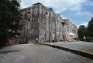
Below: The blockhause of Eperlecques was built by the Nazis
to launch V2 rockets against England.

WWII Blochaus in Northern France

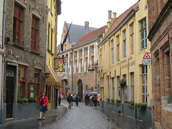
Below: Restaurants in ancient buildings
line one side of the main square in Bruges.

Square in Bruges, Belgium


When To Go:

June, July, August or September. Midsummer gives the best chance for warm, dry days, but seaside and vacation hotels space is tight.

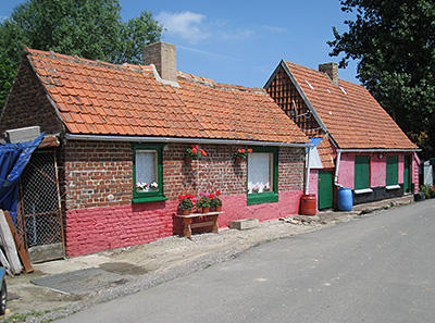
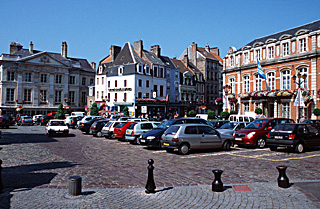
Below: In the old town of Boulogne-sur-Mer.

Main Square Boulogne-sur-MerPoints of particular interest:

At the start of the trip, the old town** of Boulogne-sur-Mer, with its rampart views, basilica, and château, are well worth an hour-long visit. A short detour from the main route, just north of Boulogne is the very pretty seaside village of Wilmereux;a visit would add no more than an extra 2 kilometers to your trip. A charming countryside of farms on rolling hills follows. The Blockhaus of Eperlecques, a site from which the Nazis launched V2 rockets against England, is interesting, and displays a collection of WWII weapons. The nearby forest along the route contains a high hill with a viewpoint.

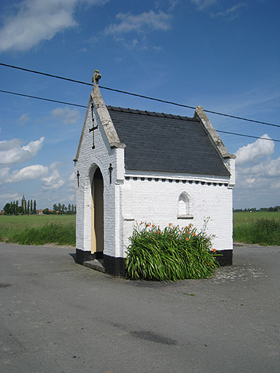
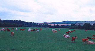
The first 60 miles (100 kilometers) of flat riding in French and Belgian Flanders are made interesting by the presence of a few pretty villages and the Yser (in France) = Ijzer (in the Netherlands) river-canal. The influence of nationality on both housing and farmland is remarkable, as one crosses the frontier into Belgium (and again, into the Netherlands). There are many minor points of interest to stop and visit, if you care to take the time. The author recomends a detour off route of less than 2 km to the Belgian town of Lo (near Pollinkhove), and of a few hundred meters into Diksmuide..

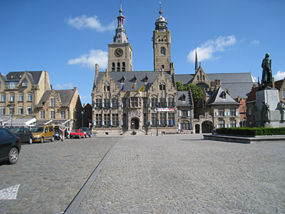
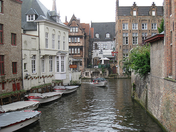
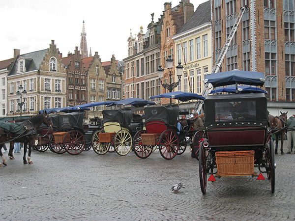
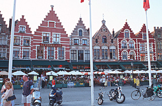
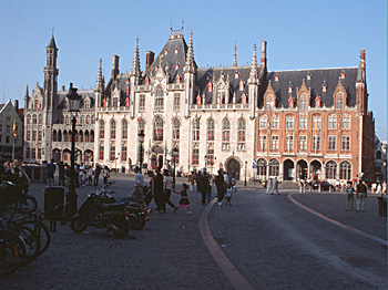
Below: On the main square, the city hall of Bruges (Brugge).

Bruge SceneYou soon arrive at the sensational little city of Bruges*** (Brugge in Flemish or Dutch), which absolutely demands a two nights' stay. Almost all Bruges building exteriors remain as they were in the 15th century. Too many fine sights exist in Bruges to list here; obtain a guidebook, or tourist information from the Bruges tourist office, or visit the excellent Internet site: http://www.brugge.be. In Bruges, do take walking tours, leaving your bike locked in a secure place at your hotel. Because of tremendous demand, somehotel rates can be on the expensive side, and on weekends space is almost not available, so try to arrive on a week day or plan weeks ahead.

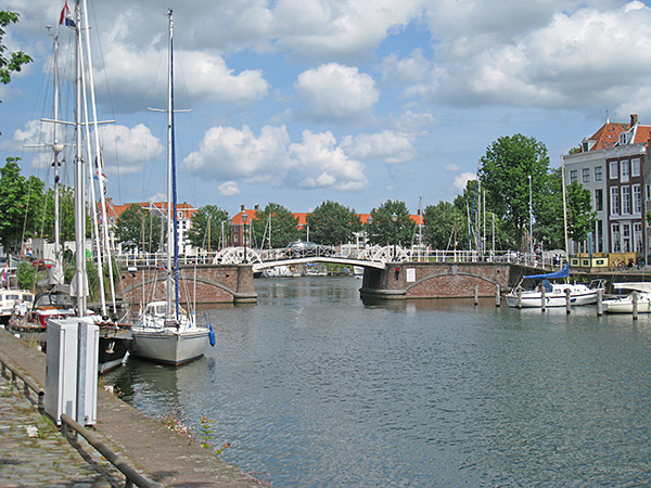
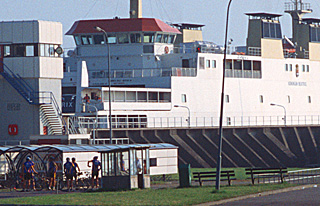
Below: Cyclists wait to board the Westerschelde ferry.

FerryAfter Bruges*** comes the Netherlands, and your first encounter with the coastal dunes. It is worth going into Sluis, as it is very charming. You will take a short ferry ride across the Westerschelde estuary. Central Middelburg merits a visit; then cross the rest of the peninsula, see perhaps the prettiest beaches of the entire trip, and pass onto the first of three 
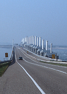
long dikes in the province of Zeeland. These are very impressive dikes**, 6, 3, and 2 miles long; the first one, in two sections, has a multitude of plates that automatically descend during storms to close off inland waters from the North Sea. In Zeeland, the land is completely flat and without many trees. You are completely exposed to the elements—don't try to cross the Zeeland penninsulas during periods of high wind and rain. After entering the province of South Holland you cross the Nieuve Maas River by ferry near Rotterdam**, to which you may make a side trip. Here you pass through a highly urban and industrialized landscape, but only for a few miles.

The last 90 miles (150 kilometers) of the Route — if you choose to ride all of it — follows bike paths and some minor roads next to, or nearby the North Sea, mainly along or through sand dunes, but also through some towns. You pass through parts of Den Haag** (The Hague), some seaside resourts and then Haarlem**. The Route ends in Den Helder at the very northwest tip of Holland.

Below: From the dike, mechanically operated
plates descend during storms to close the
estuary off from the North Sea.

Dike, Zeeland, NetherlandsFrom Den Helder and from other northern points, you may attain Amsterdam*** by train or by a ride back to the south of some 50 miles (90 kilometers), or via a long trip around the Ijselmeer (see trip discussion on this site).. You may also continue your trip to the island of Texel, and/or eastward to the German border on the LF10 route, and onwards through Germany, Denmark, and Norway..

From the Holland shore, shortcuts are possible: For example, from Zandvoort, near Harlem**, you may ride — as did the author — to Amsterdam***, entirely by bike path, in about 30 kilometers. This shortens the total trip riding distance to about 250 miles (420) kilometers.

How to Bike the North Sea Route: Organize the trip yourself, ideally with a few days flexibility to allow for unfavorable weather. The author has not located any company offering this tour, nor seen commercial groups riding.
.

Organizing the North Sea Bicycle Trip Yourself:

To print itinerary, select the text below, right click, and choose 'print selection'.

Distance and Time: 250 to 280 miles (420 to 470 kilometers), 6 to 10 days plus rain days. Trip can be extended on LF10 to the German border and beyond, or back to Amsterdam via inland roads or via the Ijsselmeer.

Starting and ending points: Boulogne-sur-Mer, France, and Den Helder (or Amsterdam), Netherlands, all accessible from Paris by trains carrying assembled bicycles. As of this writing there were several morning trains carrying bicycles from Paris, taking under 3 hours. There seems to be only one option for carrying an assembled bicycle between Amsterdam and Paris, which requires a 14 hour trip with two connections, at night, via Germany. A bike transporting bag will allow the Amsterdam -Paris trip to be done in 4 hours on a TGV. See the page of this site on "trains and bicycles" for details on bikebags and on researching and reserving trains carrying bicycles.

For cyclists coming from Belgium, Holland, or Germany, from the city of Lille it is possible, several times a day (either directly or through Calais) to bring a bicycle with you to Boulogne-sur-Mer. Lille has two railroad stations, about 500 yards (meters) apart. (From Calais it is easily possible to join up with the LF-1 Route in Watten by following the Canal de Calais. However, the author believes this would be boring, and suggests, rather, a quick train ride to Boulogne-sur-Mer).

Ferry Service operates from Folkestone, England to Boulogne. There is also return ferry service from Amsterdam to Newcastle and from Hoek van Holland to Harwich. These can be combined with train service.

For those originating in Amsterdam, a train trip (requiring use of a bikebag) to Boulogne-sur-Mer can be accomplished in 5 or 6 hours.

One day SUV car rentals can often be economical for two or more persons. Rates vary considerably from day to day. For all types of transportation, rates are usually considerably lower the further ahead you book.

Which direction to ride?: If you ride starting from Boulogne, France, as suggested here, the morning sun will generally be off to your right, particularly once you reach Belgium,and midday sun, somewhat low in the northern Netherlands sky, will be generally at your back. In the other direction, the midday and afternoon sun will tend to be in your eyes. Since riding into the sun is both hard on the eyes and reduces the clarity of views, this is probably reason enough -- all else equal -- to ride from the southwest to the northeast.

Wind: The author's limited research on the Internet ( one year'data), backed up by the comments of one Belgian drawbridge operator, suggests that, for the months of June, July, August and September, days of wind coming from the west (i.e., w, nw or sw) outnumber those from the east by a ratio of about 4 to 1. (That is, there are 66 days of wind from the west, 18 from the east, and 36 days where there is either no wind or in is from the due north or south.)

In June and July, the wind most often had a northern component (21 days from the north, 12 from the south and 28 days where there was no wind or it was from the due east or west). In August an equal number of days had a northern and southern component to the wind. In September the wind blew from a southerly direction 75% of the time.

If the Internet data is typical, it is usually advantageous throughout the trip to be biking from Boulogne to Den Helder, in the sense described below. In the more westerly parts of your trip you probably will be lucky enough to have the wind partly at your back; in the more northerly parts, in June and July ,it will probaby be at your quarter and in August and September also at your back.. This is, in fact, exactly what happened on the authors second trip in June, while in the first trip he was unlucky to have the winds against him all the way.

In summary, unless you have some other reason for beginning in Holland, it is probably best to ride from Boulogne (as decribed here).

Guide books and Maps: The author strongly recommends that you obtain and carry with you the guidebooklet : DE LF1 - Noordzeeroute (weighing 6 ounces - 146 grams). This book is in Dutch (an outdated edition in English and Frenchis no longer available). It covers the route only from Boulogne-sur-Mer to The Hague in South Holland. Published in 2006, it describes the signposting for the route (LF1), the general nature of the terrain to be traversed, and many of the minor sights to be passed (but not the major ones such as Boulogne-sur-Mer or Bruges). It contains 1:130,000 maps (from Boulogne to Bruges -- 1:150,000 from Bruges to The Hague) with the LF1 route marked (but the official route has been moved since in several places), and lists the phone numbers of some but by no means all accommodations. The maps show the distance from the south end of the route every 10 kilometers, as well as, in Holland, the marker numbers (such as 23689)of the ANWB biking signposts, and in Belgium the biking intersection point numbers (but not the ones recently introduced in the Netherlands).

(This guidebook does not, however, provide detailed directions such as highway numbers or where to turn, and also its maps lack detail and highway numbers. There appear to be errors in a couple of spots. You might wish to add highway numbers to the guidebook maps from the description below.) Note: You will need to add an 03 in front of all French telephone numbers listed in the guidebooklet, if calling from France; or insert a 3 after the 0033 if calling from out of France.

You can order the guidebook from Buijten & Schipperheijn, http://www.buijten.nl/uitgeverij_recreatief/, ISBN #90 5881 2367 (12.50 euros in 2012). To learn about shipping costs and to order, you may wish to email them at info@buijten.nl, or telephone (31)-20-524-1010. If you call, ask for somebody who speaks English.

Assuming you will continue biking up the Netherlands coast from The Hague, you will additionally need the map packet and booklets named the Nederlandse Kustroute, published in 2007; this booklet covers the route from Sluis, on the Belgian border to the Netherlands border with Germany in the northeast. The author highly recommends this map packet from Bruges onward. The maps in this booklet are bigger (1:100,000) and clearer and more up to date than the previously mentioned booklet, but do not cover Belgium and France. It can be picked up for about 18 euros (2008), in-route in Bruges, for example at the bookstore (buchhandel) on the main market square, or also ordered from Buijten & Shipperheijn, (see paragraph above) for the same price.

While not necessary, you may wish to have some larger maps to place your trip in perspective. Also, it will be extremely helpful, for France and in Belgiium as far as the Ijzer canal, to transfer highway numbers from maps onto the maps in your guide book, as they are absent. When you become lost, as you probably will several times, they can help you regain the route.

Also, do print out the map for Bruges, as is explained below in the Itinerary. And print out maps of Boulogne-sur-Mer and Den Hague, Netherlands, and Amsterdam, perhaps from Google: http://maps.google.com.

Bike Rental: Bring your bike.

Lodging: Lodging is scarce along the route, and on sunny weekends it is especially scarce, so call ahead for reservations. The North Sea Guidebook has some lodging suggestions. Additionally, in each section of the Itinerary below, you will find suggested resources in France and Belgium. In the Netherlands, try the French version of the following page on the www.holland.com site (the page was not available in the British or American versions): http://www.holland.com Click on Hôtels or B&Bs or your other choice. On the new page click on Zélande or Holland-méridion. The list is only partial. Try also http://www.hotels.n; a city often gives the list of hotels nearby. And also Booking.com and Tripadvisor.com. Web searches on the words "hotel" and a specific city will frequently turn up other alternatives which cannot be booked indirectly.

For Bruges, if you arrive without reservations and before 6pm, go to the Tourist Office near the train station.

Security Tip: Do not leave your bike out unlocked, and if leaving your bike for more than a few minutes, lock it to a fixed object. Do not leave it out overnight, or at all in the center of major Netherlands cities. The author was told this emphaticaly on his first trip, and on his latest trip a clerk from a hotel near Amsterdam voluntarily stressed the importance of this to the author, stating that stealing bicycles was a city-wide pastime in Amsterdam and a common elsewhere. Your touring bicyce will be an especially juicy target.

Helmets: Almost no Dutch or French riders wore helmets or hats along the itinerary of this trip. Potholes were virtually non-existent. I usually wore my helmet; but thought it safer to ride with a baseball cap in the mornings when heading into the rising sun.

Please refer to my home page for links to pages costs, on touring styles, transportation, bike types, rentals, maps, information sources, traffic ratings, packing, and security and safety tips. Refer to this page for information on French pronunciation, French bicycle nomenclature, and French road signs. Star symbols in the text show ratings given by the Michelin green guide books, which the author likes and uses. Three stars mean worth a journey; two, worth a detour; and one, interesting.


Itinerary:

Numbers like this [120k] inserted in the itinerary indicate , within a kilometer or two, the total distance from the beginning point of the route in Boulogne sur Mer, France. (It does not count the distance from the train station, short detours to see sights or longer detours to stay in hotels). By subtracting, you can easily calculate each day's approximate riding distance. In the Netherlands the author has not inluded kilometer numbers in the itinerary, because so many possible route variations have already accumulated.

Because riding speeds and distances will vary (due to the effects of rain, headwinds and tailwinds), and because—except for Bruges—there are no especially recommended overnight stops, this itinerary is not divided into days. Because of the wind and possible rain, unless it is a weekend it is wisest to plan only a day or two in advance. The following overnight suggestions may be helpful in planning your trip:

Possible overnight points: (All distances in this paragraph are approximate, and probably on the low side after the Belgian border, as the LF1 route has been lengthened.) Wimereux [about 2km +2 km detour],Wast [about 20km], Liques [32km], Zouafques [43km], or Recques [48km], Esquelbecq [78km], Cassel (80km + 10 km detour), Lo (of Lo-Reninge) [105km + 2km detour], Diksmuide [121km] Nieuwpoort [135], Bruges (Brugge) [173km - 2 nights highly recommended]; Middleburg, Renesse, Ouddorp, Rockanje, Brielle , Hoek van Holland , Den Haag , Scheveningen [beach amusement area, Katwije aan Zee, Noordwijk aan Zee , Zandwoort, Haarlem,Wijk aan Zee , Bergen aan Zee , Den Helder. A few other possible night spots are mentioned throughout the itinerary. See the itinerary for some reservation Internet site suggestions.

Particularly in France and initially in Belgium, you should not rely completely upon signposting, which is sporadic, but should use these directions and also the maps in your guidebook, on which you will have copied highway numbers. You should carefully study in advance the directions for the Boulogne-sur-Mer area, the Bruges area, the Brielle-Rotterdam area, and the Den Hague areas. You should also carefully study and plan your lodging possibilities in France, and again in Zeeland.

Although the directions given below have been checked by the author, they could possibly deviate from the proper LF-1 Route, due to its complexity and length, or through error. Additionally, it seems that parts of the route are moved from year to year. In the case of conflict, rely upon the signposts as as the most reliable guide to the official (but not necessarily the best) route.

Itinerary:

Note: For lodging in Boulogne-sur-Mer, Wilmereux and in the Boulonnais, and Audomarois regions of the Pas-de-Calais French Department, consult the sources as discussed in the general information section of this site, or more specifically this site: http://www.pas-de-calais.com. Click "English", the click, under "Your Stay" "Accomodations. Choose the region Boulonnais for Boulogne-sur-Mer and the nearby countryside, or choose Audomarois for the countryside up to Eperlecques. Select the type of accomodations. Do not specify any details (because the selection of choices is so small).

Boulogne-sur-Mer, France: The Author's has never ridden the official LF1 route in Boulogne-sur-Mer. Fom the guide book, here is the official route:

From the train station or other arrival point in Boulogne, procede north north west along the east side of the canal to the Office de Tourisme (tourist office). (The author did not see signs, but may have missed the first one near the station) From the tourist office continue north along route D940 until route D96, where you turn inland.

The author highly recommends a variation: rather than turning right, as above, continue straight on D940 into the town of Wimereux (this avoids most climbing and is only a slight detour), an extremely charming town. Once you hace seen the town, ride east on the south side of the little river towards Wimille (D233) and continue as in the next section, "Hilly Boulonais"and Audomarois".

After crossing the rail bridge in 500 meters, you turn right on Rue de l'Aiglon (perhaps to diminish the steepness of climb) and continue uphill untiil this isintersects the Rue Napoleon where you turn left. This shortly is renamed the Route du Chemin Vert. When you reach D96 you turn right again, and follow this until a roundabout at the Autoroute. Go 4/5ths of the way around the roundabout, exiting northwest on Rue Lèon Sergent, which veers left away from the autoroute into the village of Wimille. Turn left here onto route D233, the route for Pittefaux (not numbered on Google maps). See the continuation in the next section, "Hilly Boulonais"and Audomarois".

This variation allows you to visit the charming old town** of Boulogne-sur-Mer. From the train station at Boulogne-sur-Mer, France (hotels) ride north on Boulevard Voltaire and its extension Boulevard A. Comte. Turn right at the end on Rue Nationale, and left at the main road, Rue de Brequerecue, which becomes Rue de Porte Gayole and leads to the Ville Haute, the old, high, walled town. This is worth a one or two-hour visit. In addition to visiting the Eglise Notre Dame and walking the main street, you might wish to make a tour of the ramparts, with excellent views over the city. In the high town, at the desk in the Hotel de Ville (Town Hall), you can obtain a map of the city (which does not show one-way streets).

After you visit, from the high town, be sure to exit by the Porte de Calais, which is the gate nearest the Notre Dame church (walking your bike on the sidewalk against the direction of traffic). If you exit by any other Porte, you will ride substantially down hill and have to climb back up again. Ride straight ahead for one block, bear slightly left onto Avenue Charles de Gaulle, and immediately turn left on Rue de Marignan, one way againt you. When this ends in one block, turn left on Rue de la Paix, and in one block turn right on Rue Louis Duflos (becomes Rue de la Colonne), which runs due north. In about 600 meters (7 blocks) this crosses Rue du Chemin Vert, where you turn right heading north, northeast. This changes its name (at the intersection of Rue de lÄiglon) to Rue Napoleon and you are on the official LF1b (northbound) route (look for a possible sign here going the opposite direction).

(Shoud you wish to also visit the charming town of Wimereux, continue straight on Route du Chemin Vert, bearing left onto Route de la Poterie, which (with a name change) leads there.) Continue as described above.)

When you reach D96 you turn right , and follow this until a roundabout at the Autoroute. Go 4/5ths of the way around the roundabout, exiting northwest on Rue Lèon Sergent, which veers left away from the autoroute into the village of Wimille. Turn left here onto route D233, the route for Pittefaux (not numbered on Google maps).


Hilly Boulonnais and Audomarois, France: Follow D233 eastward to Belle, where it changes to D252 . Continue to where D252 almost reaches the National Highway N42 [15k]. Continue on D252 which bears sharply northeast here. This curves back east. In Le Wast, at the intersection of D127, turn right and then turn left. There is a hotel in Le Wast (phone 03-3-21-33-34-78 ).Continue to Colembert. In Colembert turn left near the "Mairie" on a small road (sign for Alembon) leading near Mt. Dauphin (201 meters (660 feet) high)—the highest point in northern France. (Believe it or not, at perhaps 150 meters (500 feet) you are by far at the physical high point of your trip!). In Alembon [30k], turn right on D238 for 50 meters and left on D252; the Michelin 1:200,000 map is off here. In the Sanghen, before reaching D191, with the statue of a virgin on your left, turn left and immediately right. Follow this road into Licques [33k] (hotel, guest room = chambre de hotes, about 35k from the Boulogne train station).

In Licques, at the dead end, tun right, and then immediately left in the center of the village (no signs).This leads to route D217. In Clerques, where D217 turns right continue straight on the north side of the Hem stream. At the dead end, turn left and right. (From here on, be careful not to be confused by local biking destination signs.) Pass the sign for Chappelle Saint-Louis.)

Where D217 comes in from the right, turn right into Tournehem-sur-la-Hem. After the little stream (in about 200 meters), where D217 turns left (west), you turn right. Follow this road (Rue du Vieux Château, then Rue de Tournehem). under the autoroute. It crosses D943 and turns left, now in Nordausques. (It is very easly to miss this turn; the author has missed it twice. If you do, you may want to continue across the auto route on D17, turning right on D943 (some truck traffic) and following this south past D218 and then a little stream, taking the third left turn into the village. This road turns left.

You should ignore the map in the LF1 guidebook, which is in error. When possible turn right, just before the church onto rue du Quimbergue; there is no LF1 sign here but someone has written the letters LF on the side of a building.

Flowers on hillside after Quimbergue.
Flowers

At the Y in two blocks, where there is a red fire plug and a small shelter, bear left onto Rue de la Panne.. N.B., this left is not signed. After about 2 or 3 km, the road bears left, climbs through beautiful agricultural land, and makes a U-turn back to the right before dead-ending at a yield sign.There is an excellent view here towards the North Sea. Turn right onto D219 [50k], which passes briefly through the Eperlecques Forest. Stay on this, heading mainly south, until it runs into D221 (D207?). Turn left. Watch carefully here as the LF1 sign is mainly hidden: Take the third left turn (in about 300 meters) onto rue Lostbourg. This descends into the forest and curves to the right; it is a rough road, the roughest of the North Sea Route.

In a couple of kilometers[56k], you should take the time to turn into the driveway of, and visit, the Blochaus of Eperlecques, a Nazi WWII V2 launching station for attacks on England and a factory for the production of liquid oxygen (admission fee). Some other WWII weapons are displayed. This is an interesting site, open from 10:00 to 12:00 and from 14:15 to 19:00 during the summer months. The visit could easily take an hour. (It is easy to stay on smooth (but somewhat busy) road and completely bypass the blochaus if you haven't the time or interest; just stay straight on D221 into Watten.)

Afterward your visit, turn left on the road. Cross through a tiny tunnel under a main road, and at the junction turn left. The road leads around to the right and eventually reaches a bridge, where you turn left (on D205) to cross the canal into Watten [58k]. (Chambre d'Hôte...A detour south of 8 kilometers to St. Omer may be a good idea to find a choice of hotels (about 70 kilometers total ride from the Boulogne-sur-Mer train station).

You now cross from the French Department of Pas-de_Calais into the Department of the North. For information on the gites in the region, camping, b&bs, and updated hotel information, visit the Internet site http://www.cdt-nord.fr. Click, if necessary, on the English flag. Then select the "Coeur de Flandre" region, then select accommodations. Now select the type of accomodations you are interested in. Some of the listings are on or near the Route. Given the paucity of rooms along the Route in this region, you should carefully consider planning in advance.


French Flanders:
You will climb out of Watten, but from here on the hills will diminish: you are approaching French Flanders. In Watten, turn right on D26 and in about 1500 meters bear left on D226. D226 passes through Bollezelle [70k], where there is lodging (a tiny hotel - phone 03-28-68-81-83 and a chambre d'hôte); the hotel was fully occupied on the author's first trip. You are nearby the Yser stream (Ijser in Flemish - Dutch), which you will be following, on and off, for the next 50 kilometers.

Bear left through the town square in Bollezelle . In one kilometer, at the end of D226 , turn right on D11, cross D928, and turn left immediately on the narrow Chemin de la Cloche. At a north-south road bear left and then right, now on the Rue de la Cloche. You turn right on D17 which crosses a rail line and leads into Esquelbecq (75 kilometers from Boulogne-sur-Mer, gites). Continue on D17, perhaps the busiest road of the trip with light plus traffic. Continue for 3 kilometers into Wormhout, a large town worth a stop (hotel 10 kilometer detour south in Cassel).

At Wormhout [80k] turn left at the traffic circle onto D55. Just after crossing the Autoroute, and then the bridge over the tiny Yser stream, turn immediately right and follow a back country road into Bambecque.(The author, on his lates trip took D17 and D167 to save time.) Exit the town eastward on D4-D67, and then immediately stay straight on D4 along the Yser. At the D947 crossing continue straight. The road runs through Oost-Cappel—the border with Belgium (food shopping) [92k].

Row houses near the France-Belgium border.


Belgian Flanders: Notice the remarkable and instant change in the pattern of the fields, crops, and architecture. For hotel reservation information in Belgium, try http://www.viamichelin.com. There are also many hotel reservation services listed on the Internet, which can be found by a search on Belgium, or a specific city, and hotel. For information on other types of accomodations, you might try contacting local tourist offices, or use the names recommended in the guidebooklet.

Continue straight on (Grensstraat = borderstreet and later Kallestraat). That is, when you angle into the main highway of Oost-Cappel, you should continue across in the same direction towards Hagedoorn, right along the border between France and Belgium. The author was told that there is a B&B in this area, perhaps in Beveren or Roesbrugge. The road and Lo-Reninge. At the angled intersection with highways N64 get on this highway, in the same direction as before, and in 750 meters, when the road you are on curves left, branch right on a miniscule road. At the T, turn left and immediately right onto Ekestraat. When this ends at a intersection, bear right on Elzedammé Straat (straat=street), and immediately bear left on Gapaard. At the T where, you should turn left onto Clepstraat, which becomes Tommestraat, which you follow with several name changes, until you cross the main road N8, and into the village of Pollinkhove. In the center of town, after the road has turned left (north), take a right onto Vaartstraat , and in 500 meters, after crossing the canal, another right, heading south along the far side of a picturesque canal.

Statue of lutist on the square in Lo.
Lute statue

There are two hotels in Lo. The author has stayed in the Old Abbey hotel, which was the only one open in early June, and it is of descent quality. To get to Lo (Lo-Renige on some maps), turn left (north) at the canal, ride one kilometer, and turn left on N364 into the center of this charming town worth a visit. After your visit, even though it is somewhat longer, you will probaby enjoy backtracking to the LF1 route along the canal.

You will follow this canal, in fact the Ijzer River, always staying on the same bank as far as Diksmuide. In a good kilometer, after crossing a bridge over a little stream by a lock, you turn left. There is a grassy area here for a sandwich, and a popular restaurant that is much frequented by local cyclists on weekends. You are likely to come across many many cyclists on the canal-side road. In about three kilometers, the canal turns left again, heading northeast. and in 9 more kilometers you arrive at Diksmuide (many hotels, youth hostel, camping, good bicycle store (just south and east of the Grote Markt) [120].


A reminder here regarding the use of "bike points" (the author's terminology). They are found in parts of Belgium and the Netherlands. Each point is numbered (uniquely for that region) and a sign with the number is visible, usually at bike rider height, at a junction in a road, lane, or bike path. Arrows will indicate the way from the junction to a choice of other "bike points". Sometimes, when the distances are long or there are confusing side roads or turns to make, reminder signs will show you the way to go. These signs usually save a huge amount of time in finding one's way.

Market square, Diksmuide.
Statue

From Diksmuide (bike point 1), you have a choice of routes: 1. (Bike reference point sequence 74 and 3.).That is, cross west the Ijzer canal, and turn immediately right on the Ijzer dike . At the junction keep straight (left), eventually heading due west. At the first road turn right and stay left to enter a long bike path through the countryside, exposed to the winds, heading northwest.

2. (Now signed for the North Sea Route) (Bike reference point sequence 6,2,4 and 3.) That is, ride north along the canal, and following signs, loop west in the countryside to the northwest bike path. From biking point 3 continue northwest on the bike path through bike point 38 to bike point 35. Here there is a branching. The modern route makes a long circuit through countryside to the west (points 34,33,32,16,15,72,14,4,68,5,65,65,66,82,(possibly a new route to 81 and 12 but for now:) 62,67 and 8), which may add about 20 kilometers to your trip. The "classical" route continues straight northwest on the bikepath (bike point sequence 22 and 8). All routes arrives in the town of Nieuwpoort (many hotels and campsite) [135]. A detour can be made to the coastal beaches or nearby resort towns.

Bike path and wind turbines after Nieuwpoort.
Turbines

The route classical route in Nieuwpoort follows counterclockwise the semicircular outer road of the town, PieterDeswartelaan, and before the traffic circle turns right on Siuizen. The new route cuts through the town to this point. Siuizen also forms, in miniature a counterclockwise arc. One exits at the fourth right turn, Boterdijk after crossing four canals (bike point 9). Leaving Nieuwpoort, this road in two kilometers turns sharply to the left. At the crossroads-fork (bike point 12) one continues straight on the right fork (Schuddeubeurzeweg). At the end of this turn right on Ooststraat (at or near bike point 13), which becomes Wateringstraat and follows the north side of the Plassendale-Nieuwpoort Canal for approximately 13 kilometers [158] (bike point sequence 19,18.53.54,30,29). Nearby Oudenberg has a hotel, and there also are many hotels in the resort town of Oostende, on the beach just off the route.

When this Canal dead ends, it is quite easy to go far out of your way -- unless you care to miss the very special, highly recommended city of Bruges (Brugge). The new signposting for the North Sea Route doesn't lead to Bruges, or if it does, it is by an extremely circuitious route. The classical route (that is the route followed in the late 1990s) (29,42,47,49,57,65,63,4) goes straight up the south side of another canal, the Oostende-Brugge (Bruges) Canal for about 14 kilometers, on a road. The new route, which doubles back from the northwest, is about twice as long, and is to be avoided, unless you are bypassing Bruges. A route which the author explored, not an official one in any manner, allows you to see the beautiful countryside near Bruges, and only adds about 7 or 8 extra kilometers: Follow 29,28,24,23,22,21, towards 19 (or better towards 61 if it is marked), turning right off the bicycle route to ride in the bikelane alongside the old highway into Bruges.

Chapel along the author's countryside bike route before Bruges.
Chapel, Flanders

Cyclist obtaining directions from a local rider, countryside before Bruges.
Getting Directions

City of Bruges (Brugge)***: [Around 174 KM by the classical routes, up to 220 by newer variations]. You should leave LF1 and ride or walk your bike into the center of the city By all means, print out a map of Bruges from the online tourist office at this URL: http://www.brugge.be. Search under the word "map". The tourist office(recently moved) is indicated by an I in square C10. The office can make hotel reservations for you if you have not called ahead (recommended). The site provides much useful information on Bruges tourist sights and hotels. Bruges contains three youth hostels and over 100 hotels. In the author's opinion, Bruges is one of the most wonderful towns in Europe. Stay at least two nights; you should plan to spend at least one full day touring Bruges on foot . A booklet for sale for a euroat the tourist office or in most hotels lists walking tours of the city.

Some Bruges Scenes:
Bruges Canal

Carriage in Bruges, Belgium

Bruges Street

The Noordzeeroute leaves Bruges to the northeast, along the Brugge-Sluis Canal (points 2,10,13,25,16.17,18,19,56,55,54).The signposting can be confusing; remember that you are on the LF1b (northbound) not LF1a (southbound). The ,author took a signposted detour off the canal, and regreted it. The best is to just stay along the canal(s) as per the bike numbers above. Just before the town of Sluis [190k], in about 16 kilometers, you will cross the border into the Netherlands.


Southern Zeeland (Netherlands):
The author found the transition from Belgium to the Netherlands astonishing. Though the terrain is identical, there are obvious differences in the farms, in land use, and in city style.

Normally, in the Netherlands, the LF1 route is well marked, and if you pay attention you will seldom get lost. The set of maps called "Nederlandse Kustroute" (see the discussion above) are more detailed than those of the the other guide book. For these reasons, the directions given below are usually much less detailed than those preceeding for France and Belgium. The text also no longer gives the distances from Boulogne-sur-Mer; because there have been so many possible route choices, these would probably be meaningless..

For information on hotels and other accomodations in the Netherlands, visit the Internet site http://www.holland.com.

The town of Sluis contains hotels and campsites. The town center is definitely worth a visit. To visit, where, just before the town, the LF1 crosses the canal heading east, turn left on the far bank of the canal and continue north .

Bridge over the canal at Sluis.
Little Bridge

If you visit Sluis the best route is to exit Sluis to the north along highway N675 (soon a bike path), and turn left shortly after the canal onto a new bike path. You should see a sign forLF1 and bike point 30. If you remained on the NF1b route, you will circle the ramparts of the town and ride through the countryside. (There are some markers with unique numbers on them and arrows to other markers: You'll follow 15291,24535,and 24537, before joining the bike path along N675., Then turn left as described above.

Little people.
Mushroom statue

The new route for LF1 visits the town of Retranchement (BP 30), then heads north on Moolenstraat to the village of Cadzand. You have a choice of making a 4km loop on the main route, or you can just continue staight for 1 Km and pick up the route again. When you arrive at the dunes (markers 21713 and 11187) you can decide whether to continue along the LF1 a bit inland, to the ferry terminal. But if it is not too windy, the author highly recommends riding up to the the beautiful path along the top of the dunes. Keep eastward until this path ends, continue in the same direction, until you arrive at the ferry terminal (you will briefly head south and then back north to the terminal).

There are hotels in Bresskens, just after the ferry. The ferry, which usually runs every half-hour (5 or 10 minutes before the hour - half-hour), crosses the wide Western Scheldt estuary to Vlissingen in about twenty minutes (hotels in Vlissingen).

Cheese shop in Middelburg.
Cheese Shop

From the ferry dock, the main road to the west, Paul Krugerstraat, leads in a few blocks to the Gideweg. Turn right. Soon you are along the west (east?) side of a northward-running canal, which you follow into Middelburg [220k] a charming town, (hotels, Michelin starred restaurant, 50 kilometers from Bruges). Middelburg is a logical stop, as it is a lively town, and as accommodations are rare in the subsequent 40 kilometers. A bike repair service is located in the railway station. Do not undertake the next section in rainy or excessively windy weather!

Swans seen in a village north of Middelburg.
Swans

Crossing the Zeeland and South Holland Dikes: From the center of Middleburg, at the train station, the LF1 heads north, along a warren of roads. The present routing is along N663 out of Middelburg into the country side, then along farm roads to the east of N663 north through Zanddijk to the charming town of Veere; then northwest along N663 into the village of Vrouwenpoler with some charming cafes. The route then heads due north on Fort Den Haakweg; then back east, near the shore, onto the sea dike. The beach just before the dike is the widest, cleanest and prettiest of this North Sea trip. It receives in summer many visitors from the large commercial centers to the south such as Brussels, Antwerp, Gent and even Lille.

Beach near the Stormvloedkering Dike.
Kites above North Sea

This dike becomes, the Stormvloedkering*** (storm tide dam); it is 10 kilometers long, and completely exposed to the elements. For the author, cycling across this dam (built in 1986), alongside the highway but on a separate road, was, on both his trips, a fantastic experience. The dam has huge plates which descend to stop the surge of water during big storms; otherwise the plates are left raised and the bay undergoes its natural tidal cycles. The history of this area, marked by many devastating floods, is worth learning.

The LF1 passes through the outskirts of Westenschouwen and enters the dunes and forest of Schouwen. Those with very little time could leave the route, riding northeast from Westenschouwen to Burgh, and this would probaby save 10 kilometers; but don't take this shortcut! The dunes and pine forest of Schouwen are exceptionally beautiful, and there is nothing else on this trip like them.

After reaching Burgh by the dunes, the LF1 turns northwest, back to the dunes of the north shore, which it follows to the Bouwersdam dike. The author chose to stay in land, and followed a well-frequented bike path in a nature reserve to the interesting and very busy resort town of Renesse (hotels) before picking up the LF1 near the Brouwersdam.

The Brouwersdam (roughly 5 kilometers long) leads to the island of Overflakkee, which is no longer Zeeland, but part of the province of South Holland. Once across the dike, the LF1 leads north of Ouddorp (hotels), through Goedereede, and through Havenhoofd, to the Haringvlietsluizen Dam.

You are on the island, or perhaps peninsua of Voorne. Five kilometers off the route to the left, near the town of Rockanje, there is a large resort hotel. The LF1 crosses north through Brielle, which is is an older urban enter (hotels), then heads southeast and crosses northward over two bridges into Rozenburg.

Barge along Nieuwe Waterweg looking towards Rotterdam.
Barge

A jarring sensation occurs as you cross both spans of the first bridge, then follow to the right, east, across a third span alongside a superhighway. No longer are you in the bucolic countryside of the Netherlands, but immediatlely, all too sudenly, in a modern industrial, urban landscape, with tanks, cargo ships, railroads and boat yards nearby the important port city of Rotterdam. When possible you exit the bridges and ride in a looping route through Rozenburg, down to the water of the Nieuwe Waterweg, which is the main shipping channel of Rotterdam. All of these channels are the delta of the Rhine River, which originates in the Swiss mountains and runs two-thirds the length of Germany before crossing into the Netherlands. You will soon see the Rozenburg ferry terminal on the bank, below the cliffs. The ferry crosses every 15 minutes to the town of Massluis. From here, if you wish, with the aid of detailed Holland biking maps, as described in the introduction, you could take a side trip into Rotterdam.

The mainland of Holland: LF-1 exits the ferry terminal to the left, crosses the rail line, turns left, and cross the rail line again [310k] back towards the river. It now heads north west, between the rail line and the shore of the Nieuwe Waterweg.

The route turns right on Schenkeldijk (it is easy to miss the turn) and left on Oranjedijk, but you can choose to continue on a bike route along the shore, eventually passing under the tracks and continuing on the other side into Hoek van Holland. If you are following LF1 -Oranjedijk route, this will veer right to avoid the Nieuworanjekanaal, then continue with some jogs in the same general direction to Hoek van Holland. This ride is interesting because of all the greenhouses you see, presumably growing tomatoes. There are many hotels in Hoek van Holland, which today is a beach-side resort.

The final kilometers of your trip, approximately 150 in number, follow the dunes north along the shores of the South and North Holland provinces. Much of your riding will be slow going, as the often-rough bike paths curve left and right, and go up and down many small hills. Additionally, many Dutch riders on roadster type bicycles (3 speeds or no speeds), will occasionally block your way. Cycling seems to be the passion of many of the Dutch of all ages.

A short distance inland, spaced along the route, are rail stations with connections to Amsterdam. Should you wish a faster journey once north of Wassenaar, better paved, straighter bike paths alongside the roads. For most of the passage north, the marking is excellent, and very easy to follow. Written directions, however, will help in some key trouble spots.

The route in Hoek van Holland starts two blocks to the west (towards the ocean) of the extention from highway N220 where it crosses highway E30,or you can just head north as close to the beach as possible. It soon angles left into the dunes. The route presents no problem until the middle of Den Hague**, the capital of the Netherlands [333k - 343k]. (If you have the time and inclination, it is well worth visiting the famous Mauritshuis museum there, with its Rubens, Rembrants, and Vermeers.)

Unfortunately, it is all too easy to loose the LF1 Cycle Route in Den Hague and the adjoining Schevenigen. The author has done so twice, and lost a couple of hours each time. The second time the lost author came upon the LF1 route, but it appeared to be running in the rong direction --he should have rembered that his direction was the LF1b (and yes, looking afterwards at a map, he saw that the route looped back to the correct direction). After asking for and receiving incorrect diretions on this last trip the author found himself at the seaside boardwalk in the town of Scheveningen, a sort of amusement park along the sea with tall hotels behind. It was very interesting indeed, well worth a visit, but police regulations and the crowds made it necessary to walk one's bike for two kilometers. (If you do go there, at the northeast end of the boardwalk exit to the main road a long block east. Not at the streetcar turnaround at the end of the road, nor taking the path into the dunes here, but rather back southwest a long block go inland - left -on a walk. This joins a road which angles back from a block further on, but avoids the traffic.. Turn left when possible on a road then path into the dones, and this will join the LF1 at marker 22726.

Here are directions for Den Haag - Scheveningen: After the town of Monster, you will be following very close to the beach. In Kjkduin you will have to turn right for a couple of blocks, then left, to cross (under?) a highway, before turningwhile left again and right back to the shore bike path. The city of Den Haag will be off to your right. Continue along the shore almost 3 Km until the LF1 curves inland and you go along a neighborhood street in the same direction. Turn right, left, left and then angle right (to cross a bridge over a canal), then pass near a harbor (on Dr Lelykadestraat or perhaps Koppelstokstraat). You need to get inland (and while this may not be the official route, it will do) you can take Van Bergenstraat right (becomes Statenlaan (one way your way, and in two or three blocks turn left on Doomstraat. Branch left still on Doomstraat, and stay left at the junction. At the next junction branch left on Johan van Oldenbameveltaan, and then take the next right onto Van Dorpstraat, which runs into the major artery Scheveningseweg. (if you arrive at Scheveningseweg by some other routing, fine! The author made it to this street on both trips, but then lost his way. )

Turn right and take the very next left, just before a park on the left. This is called Kanalweg. If you have gone astray, you should be able to spot this park, which is the first of several as you come inland, and the turn just before it. Branch right immmediately from Kanalweg onto Van Stoklaan, and turn right at the next intersection on the one way Van Stolkweg. At the end of this turn left on Hogeweg, and at the end bear right onto Duinweg, now completely in the park. According to the LF1 map there is a bike path that cuts off the loop on Duinweg, but in any event you regain Duinweg and ride to a T. Turn right on Haringkade across a canal, take the next left across a another, perpendicular canal, and turn right imediately onto Wagenaarweg, now outsde the park. Stay on Wagenaarweg until it ends at a major intersection (Badhuisweg) where you bear left, or possibly just go straight across into a divided road, Pompstationsweg. After a long ride, at the very end of this, you bear left and right into the dunes.

Normally, in the dunes, you will have passed Dutch bikers ambling along on their one-or-three speed city bikes, but now, near Wassenaar, you meet riders in cycling clothes on their expensive racing bikes: Wassenaar is the Beverly Hills of Holland. Stars live there, as well as executives that commute to towns as far away as Amsterdam.

You pass through Katwijk Aan Zee (hotels) (before the town, the Route turns left and then right, passing just along the ocean). Continue north to Noordwijk (hotels) and Zandvoort* (hotels, 60 kilometers from Hoek van Holland). Just before Zandvoort you enter the province of North Holland. Again, in Zandvoort, you may become lost. The LF1 turns inland to Bentveld, branches briefly north near a canal, and bears left. At the T turn right, riding east northeas near a rail line. The bike path bears right and ends at Duinlustweg. Turn left and follow to Browerskolkweg, on the outskirts of Harlem, where you take a very sharp left to continue on the LF1b. Bear right here, still on the Duinslustweg, to ride to Amsterdam. (The easiest way, about 30-35 Km, not devoid of traffic, to be sure, may be to curve north -name changes to Korte Zigweg and Bloemendaalseweg - crossing the rail line to the traffic circle. Turn right on N200, the Julianalaan, with bike lanes. At the end of this, at the big traffic circle go right - still on N200 - the Versproonckweg, also with bike lanes. This becomes the Oudeweg. Then N200 turns right, but stay on the Oudeweg, and where this curves right and changes names, bear left on the a. Hofmanweg, and imediately right two times to pick up a bike path heading south. At the T turn left, riding north of the rail line. The route will be marked from here, if not earlier.) There are many other routes to Amsterdam, and sign posts will indicate the way there, as well as to the towns on the way.

The author has never ridden the remainder the remainder of the LF1, as he rode both times to Amsterdam. The following description is based upon maps and reading.

After the Brouwerkskolkweg, the LF1 enters the Bloemendaal National Park, again as a bike path, about 2-3 kilometers in from the sea.

At the Nordsee Kanaal, the bike path comes to an end, and one rides left a short distance to the ferry dock, or by continuing further west(!), one can ride across the sluices, from which the road merges with that from the ferry. The town of Ijmuiden is industrial. There is a bicycle path from the ferry eastward, along the south shore of the canal, that leads, in about 19 kilometers, directly to central Amsterdam.

From the ferry, the LF-1 continues due north, zigzagging right and left, and in about 4 kilometers reenters the dunes. Hotels are available just off the route in Wijk aan Zee, Bergen aan Zee, and Schoorl aan Zee, respectively 77, 102, and 107 kilometers from Hoek van Holland. In Alkmaar (hotels), a short detour inland, the sight of the 10:00 a.m. cheese market is worth the detour.

The final 40 kilometers of the Nordzeeroute follows alongside or within the dunes, and there is almost no chance of becoming lost. About 20 kilometers before the route's end [449k], you could branch right on Route LF-10, which leads across the Ijsselmeer dike (see the Ijsselmeer page on this site), and eventually to the German border. In Den Helder [470k], you could take a ferry to the northern island of Texel,from which you can loop back to the LF-10. The Nederlandse Kustroute map set provides maps that give all the alternative routes as far as the German border. You can also catch the train for Amsterdam, or should you feel the need for more time in the saddle, via an inland route or via the Ijsselmeer route described elsewhere on this site, bike back to Amsterdam.

To List of Great European Bike Tours

Home Page